| [3] |
Name on the Register[4] |
Image |
Date listed[5] |
Location |
Neighborhood |
Description |
|---|
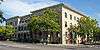
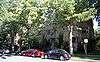
| 1 |
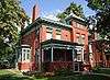
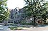
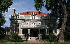
Altamaha Apartments |
|
May 5, 2004
(#04000382) |
1490 Lafayette St.
39°44′23″N 104°58′11″W / 39.739722°N 104.969722°W / 39.739722; -104.969722 (Altamaha Apartments) |
Cheesman Park |
|
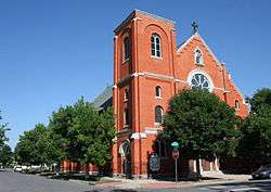
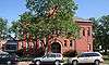
| 2 |
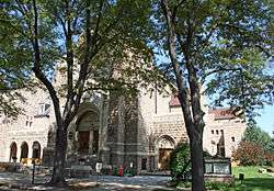
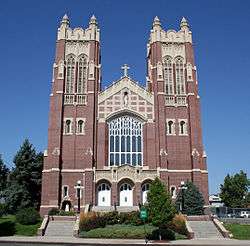
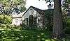
Annunciation Church |
|
June 21, 1990
(#90000869) |
3601 Humboldt St.
39°46′02″N 104°58′11″W / 39.767222°N 104.969722°W / 39.767222; -104.969722 (Annunciation Church) |
Cole |
|
| 3 |
Auraria 9th Street Historic District |
|
March 26, 1973
(#73000466) |
9th St. from Curtis to Champa St.
39°44′30″N 105°00′12″W / 39.741667°N 105.003333°W / 39.741667; -105.003333 (Auraria 9th Street Historic District) |
Auraria |
|
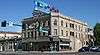
| 4 |
Austin Building |
|
January 11, 1996
(#95001512) |
2400-2418 E. Colfax and 1472 Josephine St.
39°44′24″N 104°57′28″W / 39.74°N 104.957778°W / 39.74; -104.957778 (Austin Building) |
Congress Park |
|
| 5 |
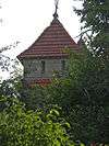
Bastien's Restaurant |
|
September 30, 2009
(#09000774) |
3503 E. Colfax Ave.
39°44′26″N 104°56′46″W / 39.740494°N 104.946203°W / 39.740494; -104.946203 (Bastien's Restaurant) |
City Park |
|
| 6 |
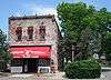
Bats Grocery Store |
|
January 28, 1988
(#87002545) |
4336 Clayton St.
39°46′37″N 104°57′12″W / 39.776944°N 104.953333°W / 39.776944; -104.953333 (Bats Grocery Store) |
Elyria Swansea |
|
| 7 |
Bluebird Theater |
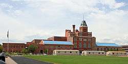
|
January 31, 1997
(#97000018) |
3315-3317 E. Colfax Ave.
39°44′26″N 104°56′52″W / 39.740556°N 104.947778°W / 39.740556; -104.947778 (Bluebird Theater) |
City Park |
|
| 8 |
Bonfils Memorial Theatre |
|
December 27, 2006
(#91001417) |
1475 Elizabeth St.
39°44′24″N 104°57′21″W / 39.74°N 104.955833°W / 39.74; -104.955833 (Bonfils Memorial Theatre) |
Congress Park |
|
| 9 |
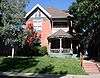
Richard Crawford Campbell House |
|
July 3, 1979
(#79000578) |
909 York St.
39°43′51″N 104°57′35″W / 39.730833°N 104.959722°W / 39.730833; -104.959722 (Richard Crawford Campbell House) |
Cheesman Park |
|
| 10 |
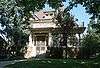
Delos Allen Chappell House |
|
June 3, 1982
(#82002293) |
1555 Race St.
39°44′28″N 104°57′47″W / 39.741111°N 104.963056°W / 39.741111; -104.963056 (Delos Allen Chappell House) |
City Park West |
|
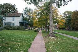
| 11 |
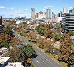
Cheesman Park |
|
September 17, 1986
(#86002221) |
Roughly bounded by E. 13th Ave., High St., E. 8th Ave., and Franklin St.
39°43′58″N 104°57′57″W / 39.732778°N 104.965833°W / 39.732778; -104.965833 (Cheesman Park) |
Cheesman Park |
|
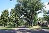
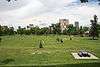
| 12 |
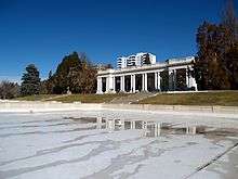
City Park |
|
September 17, 1986
(#86002190) |
Roughly bounded by E. 23rd Ave., Colorado Boulevard, E. 17th Ave., and York St.
39°44′50″N 104°56′59″W / 39.747222°N 104.949722°W / 39.747222; -104.949722 (City Park) |
City Park |
|
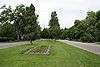
| 13 |
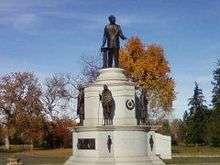
City Park Esplanade |
|
September 17, 1986
(#86002177) |
City Park Esplanade from E. Colfax Ave. to E. 17th Ave.
39°44′31″N 104°57′22″W / 39.741944°N 104.956111°W / 39.741944; -104.956111 (City Park Esplanade) |
City Park |
|
| 14 |
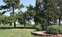
City Park Golf |
|
September 17, 1986
(#86002198) |
Roughly bounded by E. 26th Ave., Colorado Boulevard, E. 23rd Ave., and York St.
39°45′10″N 104°57′00″W / 39.752778°N 104.95°W / 39.752778; -104.95 (City Park Golf) |
Skyland |
|
| 15 |
George W. Clayton Trust and College |
|
May 2, 2006
(#06000329) |
3801 Martin Luther King Boulevard
39°45′46″N 104°56′34″W / 39.762778°N 104.942778°W / 39.762778; -104.942778 (George W. Clayton Trust and College) |
Clayton |
|
| 16 |
Cole Neighborhood Historic District |
|
March 31, 1995
(#95000264) |
3200-3300 Vine and Race Sts.
39°45′48″N 104°57′45″W / 39.763333°N 104.9625°W / 39.763333; -104.9625 (Cole Neighborhood Historic District) |
Cole |
|
| 17 |
Denver Medical Depot |
|
June 3, 1998
(#98000650) |
3800 York St.
39°46′13″N 104°57′15″W / 39.770278°N 104.954167°W / 39.770278; -104.954167 (Denver Medical Depot) |
Clayton |
|
| 18 |
Denver Orphans' Home |
|
January 15, 1999
(#98001606) |
1501 Albion St.
39°44′27″N 104°56′20″W / 39.740833°N 104.938889°W / 39.740833; -104.938889 (Denver Orphans' Home) |
South Park Hill |
|
| 19 |
Dow-Rosenzweig House |
|
June 3, 1982
(#82002294) |
1129 E. 17th Ave.
39°44′37″N 104°58′20″W / 39.743611°N 104.972222°W / 39.743611; -104.972222 (Dow-Rosenzweig House) |
City Park West |
|
| 20 |
Doyle-Benton House |
|
January 18, 2006
(#05001527) |
1301 Lafayette St.
39°44′13″N 104°58′13″W / 39.736944°N 104.970278°W / 39.736944; -104.970278 (Doyle-Benton House) |
Cheesman Park |
|
| 21 |
East High School |
|
July 27, 2006
(#06000660) |
1545 Detroit St.
39°44′32″N 104°57′19″W / 39.742222°N 104.955278°W / 39.742222; -104.955278 (East High School) |
City Park |
|
| 22 |
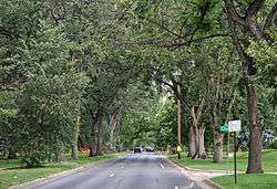
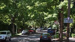
East Sixth Avenue Parkway |
|
September 17, 1986
(#86002214) |
E. 6th Ave. Parkway from Colorado Boulevard to Quebec St.
39°43′07″N 104°55′38″W / 39.718611°N 104.927222°W / 39.718611; -104.927222 (East Sixth Avenue Parkway) |
Hale and Montclair |
Extends into Hilltop in Southeast Denver |
| 23 |
East Seventh Avenue Parkway |
|
September 17, 1986
(#86002217) |
E. 7th Ave. Parkway from Williams St. to Colorado Boulevard
39°43′37″N 104°57′06″W / 39.726944°N 104.951667°W / 39.726944; -104.951667 (East Seventh Avenue Parkway) |
Country Club and Congress Park |
|
| 24 |
East Seventeenth Avenue Parkway |
|
September 17, 1986
(#86002200) |
E. 17th Ave. Parkway from Colorado Boulevard to the Monaco St. Parkway
39°44′36″N 104°55′35″W / 39.743333°N 104.926389°W / 39.743333; -104.926389 (East Seventeenth Avenue Parkway) |
South Park Hill |
|
| 25 |
Emmanuel Shearith Israel Chapel |
|
December 1, 1969
(#69000041) |
1201 10th St.
39°44′39″N 105°00′12″W / 39.744167°N 105.003333°W / 39.744167; -105.003333 (Emmanuel Shearith Israel Chapel) |
Auraria |
|
| 26 |
First Unitarian Society of Denver |
|
July 14, 2017
(#100001308) |
1400 Lafayette St.
39°44′19″N 104°58′13″W / 39.738727°N 104.970339°W / 39.738727; -104.970339 (First Unitarian Society of Denver) |
City Park West |
|
| 27 |
Forest Street Parkway |
|
September 17, 1986
(#86002203) |
Forest St. Parkway from 17th Ave. to Montview Boulevard
39°44′44″N 104°55′36″W / 39.745556°N 104.926667°W / 39.745556; -104.926667 (Forest Street Parkway) |
South Park Hill |
|
| 28 |
Ernest LeNeve Foster House |
|
September 4, 1980
(#80000891) |
2105 Lafayette St.
39°44′54″N 104°58′14″W / 39.748333°N 104.970556°W / 39.748333; -104.970556 (Ernest LeNeve Foster House) |
City Park West |
|
| 29 |
Russell and Elinor Gates Mansion |
|
March 7, 2002
(#02000152) |
1365-1375 Josephine
39°44′17″N 104°57′30″W / 39.738056°N 104.958333°W / 39.738056; -104.958333 (Russell and Elinor Gates Mansion) |
Congress Park |
|
| 30 |
House at 1750 Gilpin Street |
|
July 7, 2004
(#04000661) |
1750 Gilpin St.
39°44′39″N 104°57′59″W / 39.744167°N 104.966389°W / 39.744167; -104.966389 (House at 1750 Gilpin Street) |
City Park West |
|
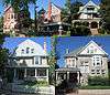
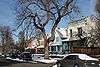
| 31 |
Humboldt Street Historic District |
|
December 29, 1978
(#78000848) |
Humboldt St. between E. 10th and E. 12th Sts.
39°44′01″N 104°58′07″W / 39.733611°N 104.968611°W / 39.733611; -104.968611 (Humboldt Street Historic District) |
Cheesman Park |
|
| 32 |
Owen E. LeFevre House |
|
August 13, 1976
(#76000552) |
1311 York St.
39°44′14″N 104°57′35″W / 39.737222°N 104.959722°W / 39.737222; -104.959722 (Owen E. LeFevre House) |
Cheesman Park |
|
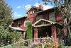
| 33 |
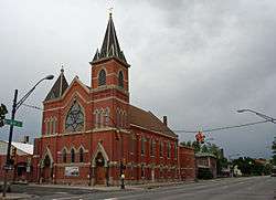
Macedonia Baptist Church |
|
April 6, 2015
(#15000125) |
3240 Adams St.
39°45′44″N 104°56′55″W / 39.7623°N 104.9485°W / 39.7623; -104.9485 (Macedonia Baptist Church) |
|
|
| 34 |
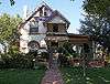
Peter McCourt House |
|
May 9, 1983
(#83001313) |
1471 High St.
39°44′24″N 104°57′51″W / 39.74°N 104.964167°W / 39.74; -104.964167 (Peter McCourt House) |
Cheesman Park |
|
| 35 |
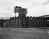
Midwest Steel and Iron Works Company Complex |
|
April 10, 1985
(#85000858) |
25 Larimer St.
39°44′27″N 105°00′55″W / 39.740833°N 105.015278°W / 39.740833; -105.015278 (Midwest Steel and Iron Works Company Complex) |
Lincoln Park |
|
| 36 |
Monaco Street Parkway |
|
September 17, 1986
(#86002207) |
Monaco St. Parkway from E. 1st Ave. to Montview Boulevard
39°43′58″N 104°54′43″W / 39.732778°N 104.911944°W / 39.732778; -104.911944 (Monaco Street Parkway) |
Montclair and South Park Hill |
Extends into Hilltop in Southeast Denver |
| 37 |
Montclair Park |
|
September 17, 1986
(#86002213) |
Roughly bounded by E. 12th Ave., Onieda St., and the Richthofen Parkway
39°44′06″N 104°54′30″W / 39.735°N 104.908333°W / 39.735; -104.908333 (Montclair Park) |
Montclair |
|
| 38 |
Montview Boulevard |
|
October 1, 1986
(#86002205) |
Montview Boulevard from Colorado Boulevard to Monaco St. Parkway
39°44′51″N 104°55′36″W / 39.7475°N 104.926667°W / 39.7475; -104.926667 (Montview Boulevard) |
South Park Hill |
|
| 39 |
Montview Boulevard Presbyterian Church |
|
April 6, 2004
(#04000262) |
1980 Dahlia St.
39°44′49″N 104°55′52″W / 39.746944°N 104.931111°W / 39.746944; -104.931111 (Montview Boulevard Presbyterian Church) |
South Park Hill |
|
| 40 |
Motor Coach Division Building-Denver Tramway Company |
|
December 17, 1998
(#98001517) |
3500 Gilpin St.
39°46′00″N 104°58′02″W / 39.766667°N 104.967222°W / 39.766667; -104.967222 (Motor Coach Division Building-Denver Tramway Company) |
Cole |
|
| 41 |
Park Hill |
|
December 16, 2004
(#04001348) |
Bounded by Colorado Boulevard, E. 26th Ave., Dahlia St., and E. Montview Boulevard
39°45′04″N 104°56′09″W / 39.751111°N 104.935833°W / 39.751111; -104.935833 (Park Hill) |
North Park Hill and South Park Hill |
|
| 42 |
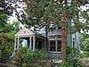
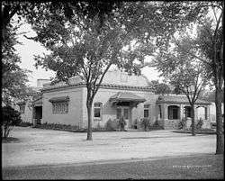
Pearce-McAllister Cottage |
|
June 20, 1972
(#72000271) |
1880 Gaylord St.
39°44′46″N 104°57′37″W / 39.746111°N 104.960278°W / 39.746111; -104.960278 (Pearce-McAllister Cottage) |
City Park West |
|
| 43 |
Peoples Presbyterian Church |
|
July 18, 2016
(#16000448) |
2780 York St.
39°45′25″N 104°57′35″W / 39.756811°N 104.959716°W / 39.756811; -104.959716 (Peoples Presbyterian Church) |
|
|
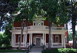
| 44 |
Wilbur S. Raymond House |
|
November 21, 1974
(#74000570) |
1572 Race St.
39°44′29″N 104°57′54″W / 39.741389°N 104.965°W / 39.741389; -104.965 (Wilbur S. Raymond House) |
City Park West |
|
| 45 |
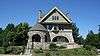
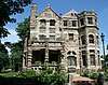
Richthofen Castle |
|
April 21, 1975
(#75000511) |
7020 E. 12th Ave.
39°44′07″N 104°54′22″W / 39.735278°N 104.906111°W / 39.735278; -104.906111 (Richthofen Castle) |
Montclair |
|
| 46 |
Richthofen Monument |
|
September 17, 1986
(#86002212) |
Richthofen Parkway at Oneida St.
39°44′03″N 104°54′27″W / 39.734167°N 104.9075°W / 39.734167; -104.9075 (Richthofen Monument) |
Montclair |
|
| 47 |
Richthofen Place Parkway |
|
September 17, 1986
(#86002209) |
Richthofen Pl. Parkway from the Monaco St. Parkway to Oneida St.
39°44′03″N 104°54′32″W / 39.734167°N 104.908889°W / 39.734167; -104.908889 (Richthofen Place Parkway) |
Montclair |
|
| 48 |
Riverside Cemetery |
|
October 28, 1994
(#94001253) |
5201 Brighton Boulevard
39°47′39″N 104°57′33″W / 39.794167°N 104.959167°W / 39.794167; -104.959167 (Riverside Cemetery) |
Elyria-Swansea |
Extends into North Washington in Adams County |
| 49 |
Robinson House |
|
February 12, 2003
(#03000003) |
3435 Albion St.
39°45′55″N 104°56′20″W / 39.765278°N 104.938889°W / 39.765278; -104.938889 (Robinson House) |
Northeast Park Hill |
|
| 50 |
St. Elizabeth's Church |
|
December 1, 1969
(#69000043) |
1062 11th St.
39°44′34″N 105°00′06″W / 39.742778°N 105.001667°W / 39.742778; -105.001667 (St. Elizabeth's Church) |
Auraria |
|
| 51 |
St. Ignatius Loyola Church |
|
December 23, 1994
(#94001468) |
Junction of E. 23rd Ave. and York St.
39°45′05″N 104°57′35″W / 39.751389°N 104.959722°W / 39.751389; -104.959722 (St. Ignatius Loyola Church) |
Whittier |
|
| 52 |
St. Joseph's Roman Catholic Church of Denver |
|
June 3, 1982
(#82002295) |
600 Galapago
39°43′34″N 104°59′44″W / 39.726111°N 104.995556°W / 39.726111; -104.995556 (St. Joseph's Roman Catholic Church of Denver) |
Lincoln Park |
|
| 53 |
Saint Philomena Catholic Parish School |
|
May 4, 2011
(#11000239) |
940 Fillmore St.
39°43′54″N 104°57′08″W / 39.731667°N 104.952222°W / 39.731667; -104.952222 (Saint Philomena Catholic Parish School) |
Congress Park |
|
| 54 |
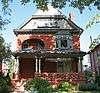
Schlessinger House |
|
November 14, 1979
(#79000591) |
1544 Race St.
39°44′28″N 104°57′46″W / 39.741111°N 104.962778°W / 39.741111; -104.962778 (Schlessinger House) |
City Park West |
|
| 55 |
Smith House |
|
September 26, 1985
(#85002566) |
1801 York St.
39°44′42″N 104°57′35″W / 39.745°N 104.959722°W / 39.745; -104.959722 (Smith House) |
City Park West |
|
| 56 |
Milo A. Smith House |
|
July 3, 1997
(#97000658) |
1360 Birch St.
39°44′15″N 104°56′09″W / 39.7375°N 104.935833°W / 39.7375; -104.935833 (Milo A. Smith House) |
Hale |
|
| 57 |
Pierce T. Smith House |
|
September 20, 1984
(#84000823) |
1751 Gilpin St.
39°44′40″N 104°58′01″W / 39.744444°N 104.966944°W / 39.744444; -104.966944 (Pierce T. Smith House) |
City Park West |
|
| 58 |
South Platte River Bridges |
|
October 15, 2002
(#02001128) |
Interstate 25 at milepost 210.53
39°44′36″N 105°00′56″W / 39.743333°N 105.015556°W / 39.743333; -105.015556 (South Platte River Bridges) |
Auraria |
Extends into Jefferson Park and Sun Valley in West Denver |
| 59 |
Speer Boulevard |
|
September 17, 1986
(#86002240) |
Speer Boulevard from W. Colfax Ave. to Downing St.
39°43′42″N 104°59′09″W / 39.728333°N 104.985833°W / 39.728333; -104.985833 (Speer Boulevard) |
Lincoln Park |
Extends into Civic Center in Downtown Denver and Speer in Southeast Denver |
| 60 |
Stanley Arms |
|
July 15, 1999
(#99000823) |
1321-1333 E. 10th Ave.
39°43′57″N 104°58′13″W / 39.7325°N 104.970278°W / 39.7325; -104.970278 (Stanley Arms) |
Cheesman Park |
|
| 61 |
Stanley School-Montclair School |
|
February 13, 2007
(#07000038) |
1301 Quebec St.
39°44′15″N 104°54′12″W / 39.7375°N 104.903333°W / 39.7375; -104.903333 (Stanley School-Montclair School) |
Montclair |
Now used as a private preschool.[6] |
| 62 |
Sunken Gardens |
|
September 17, 1986
(#86002247) |
Roughly bounded by Speer Boulevard, W. 8th Ave., Delaware, and Elati Sts.
39°43′49″N 104°59′30″W / 39.730278°N 104.991667°W / 39.730278; -104.991667 (Sunken Gardens) |
Lincoln Park |
|
| 63 |
Tears-McFarlane House |
|
January 11, 1976
(#76000557) |
1290 Williams St.
39°44′12″N 104°57′56″W / 39.736655°N 104.965688°W / 39.736655; -104.965688 (Tears-McFarlane House) |
Cheesman Park |
|
| 64 |
Tivoli Brewery Company |
|
April 11, 1973
(#73000469) |
1320-1348 10th St.
39°44′43″N 105°00′17″W / 39.745278°N 105.004722°W / 39.745278; -105.004722 (Tivoli Brewery Company) |
Auraria |
|
| 65 |
Treat Hall at Johnson & Wales University |
|
August 10, 1978
(#78000855) |
E. 18th Ave. and Pontiac St.
39°44′44″N 104°54′15″W / 39.745556°N 104.904167°W / 39.745556; -104.904167 (Treat Hall at Johnson & Wales University) |
South Park Hill |
|
| 66 |
Vine Street Houses |
|
December 16, 1974
(#74000572) |
1415, 1429, 1435, 1441, and 1453 Vine St.
39°44′21″N 104°58′01″W / 39.739167°N 104.966944°W / 39.739167; -104.966944 (Vine Street Houses) |
Cheesman Park |
|
| 67 |
Manuella C. Walters Duplex |
|
September 30, 2009
(#09000775) |
1728 and 1732 Gilpin St.
39°44′38″N 104°58′02″W / 39.743925°N 104.9672°W / 39.743925; -104.9672 (Manuella C. Walters Duplex) |
City Park West |
|
| 68 |
West Side Court Building |
|
May 5, 2004
(#04000383) |
924 W. Colfax Ave.
39°44′23″N 104°59′57″W / 39.739722°N 104.999167°W / 39.739722; -104.999167 (West Side Court Building) |
Lincoln Park |
|
| 69 |
Westside Neighborhood |
|
April 17, 1975
(#75000516) |
1311-1466 Lipan St., 1305-1370 Kalamath St., 931-1126 W. 14th Ave., 1312-1438 Maraposa St., and 1008-1118 W. 13th Ave.
39°44′17″N 105°00′08″W / 39.738056°N 105.002222°W / 39.738056; -105.002222 (Westside Neighborhood) |
Lincoln Park |
|
| 70 |
Zall House |
|
November 9, 2005
(#05001207) |
5401 E. 6th Ave. Parkway
39°43′33″N 104°55′27″W / 39.725833°N 104.924167°W / 39.725833; -104.924167 (Zall House) |
Hale |
|
| 71 |
Zeitz Buckhorn Exchange |
|
April 21, 1983
(#83001292) |
1000 Osage St.
39°43′56″N 105°00′58″W / 39.732222°N 105.016111°W / 39.732222; -105.016111 (Zeitz Buckhorn Exchange) |
Lincoln Park |
|