National Cycle Route 10
| NCN Route 10 | |
|---|---|
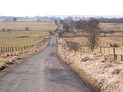 Route 10 in Northumberland | |
| Length | 208 km (129 mi) |
| Location | Cumbria and Northumberland, UK |
| Designation | UK National Cycle Network |
| Trailheads | Cockermouth (west) to North Shields (east) |
| Use | Cycling |
| Elevation | |
| Highest point | Caplestone Fell, 366 m (1,201 ft) |
| Lowest point | North Shields, 6 m (20 ft) |
| Cycling details | |
| Trail difficulty | Challenging |
| Website | sustrans.org.uk |
National Cycle Network (NCN) Route 10 is a Sustrans National Route that runs from Cockermouth to North Shields. The route is 129 miles (208 km) in length and is fully open and signed in both directions.[1]
History
Route 10 forms the majority of the 187 miles (301 km) Reivers Cycle Route which was conceived to be a mirror image of the popular C2C cycle route[2]. Originally Route 10 was designated as Suatrans regional route and signed with blue numbers[3]. It has been reclassied as a national route with red numbers.[4]
Route
Cockermouth to Carlisle
The western trailhead is at Cockermouth. It uses minor roads as far as Dalston where it joins Route 7 and follows the Caldew Cycleway riverside traffic-free path into central Carlisle.
Carlisle to Bellingham
Heading north out of Carlise the route continues to follow Route 7 on minor roads as far as Westlinton and continues as Route 10 into the Kershope Forest where it meets the Scottish border.[5] Mainly traffic-free through the Kielder Forest to the reservoir where it continues on minor roads to Bellingham.
Bellingham to North Shields
Heading east the route follows minor roads to Ponteland. Passing to the north of Newcastle upon Tyne the route reaches its eastern trailhead at Percy Main, North Shields.
Related NCN routes
Route 10 is part of the Reivers Cycle Route route along with[6]:
Route 10 meets the following routes:
- 71 at Cockermouth
- 7 at Dalston and Westlinton
- 68 at Bellingham
- 72 at Percy Main
References
- ↑ "Route 10 - Map". Sustrans. Retrieved 2 March 2018.
- ↑ "The Reivers Cycle Route (NCN Route 10)". Cycle Pad Northumberland - Everything Cycling. Retrieved 2 March 2018.
- ↑ Discover Three Rivers : cycle routes map. Bristol: Sustrans. 2007. ISBN 1901389685.
- ↑ "Route numbering system". Sustrans. Retrieved 2 March 2018.
- ↑ "Reivers Route Day 3 - Tarset to Newcastleton ~ Cycleit2". Cycleit2. 9 June 2016. Retrieved 2 March 2018.
- ↑ "Reivers Route - Map". Sustrans. Retrieved 2 March 2018.
External links
| Wikimedia Commons has media related to National Cycle Network route 10. |