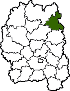
Narodychi Raion
| Narodychi Raion Народицький район | |||
|---|---|---|---|
| Raion | |||
| |||
 | |||
| Coordinates: 51°12′21″N 29°4′29″E / 51.20583°N 29.07472°ECoordinates: 51°12′21″N 29°4′29″E / 51.20583°N 29.07472°E | |||
| Country |
| ||
| Region | Zhytomyr Oblast | ||
| Admin. center | Narodychi | ||
| Subdivisions |
List
| ||
| Area | |||
| • Total | 1,284 km2 (496 sq mi) | ||
| Population (2013) | |||
| • Total |
| ||
| Time zone | UTC+2 (EET) | ||
| • Summer (DST) | UTC+3 (EEST) | ||
| Area code | +380 | ||
Narodychi Raion (Ukrainian: Народицький район) is a raion (district) of Zhytomyr Oblast, northern Ukraine. Its administrative centre is located at Narodychi. The raion covers an area of 1,284 square kilometres (496 sq mi). Population: 9,573 (2013 est.)[1]
History
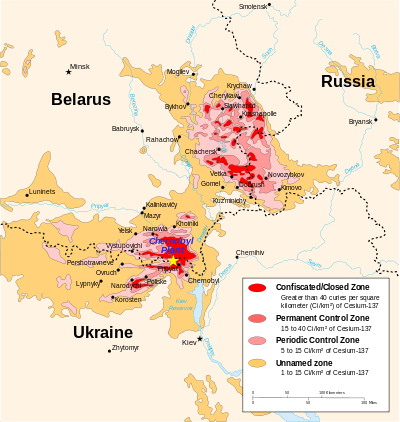
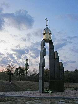
Eastern part of the district includes protection areas similar to those of Chernobyl Exclusion Zone which were heavily polluted as a result of the radioactive fallout from Chernobyl disaster in 1986.
Gallery
References
- ↑ "Чисельність наявного населення України (Actual population of Ukraine)" (in Ukrainian). State Statistics Service of Ukraine. Retrieved 21 January 2015.
External links
![]()
| Raions | |||||
|---|---|---|---|---|---|
| Cities |
| ||||
| |||||
This article is issued from
Wikipedia.
The text is licensed under Creative Commons - Attribution - Sharealike.
Additional terms may apply for the media files.