Nappa Merrie


Nappa Merrie Station most commonly known as Nappa Merrie is a pastoral lease that operates as a cattle station in central west Queensland, Australia.
Description
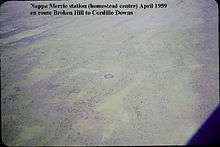
The property is located 40 kilometres (25 mi) north east of Innamincka and 260 kilometres (162 mi) south east of Birdsville in the Channel Country of Queensland. It has double frontage to Coopers Creek and is bounded to the west by the South Australian border.[1]
The station currently occupies an area of 7,275 square kilometres (2,809 sq mi) and is able to carry 11,000 head of cattle. It is currently owned by Morella Agriculture (David Coulton) and is managed by Peter Degoumois.[2][3][4]
History
The traditional owners of the area are the Wongkumara peoples, the name comes from the words ngappa meaning water and merri meaning sandhill.[5]
The property doesn't have a huge number of channels through the area but is part of a natural floodplain and contains low lying swamps that provide excellent feed after floodouts that last until the dry season. The homestead has been built above and adjacent to the Nappa Merrie waterhole.[6]
The station was one of the first established along Cooper Creek, taken up in 1871 by John Conrick.[7] Conrick and five companions, all under the age of 21, overlanded a herd of about 1,000 cattle to the property from Warrnambool to stock the station.[8] The Conrick family later took up the Chasleton lease and remained on the station for the next 83 years. From 1892 to 1934 the property was running mostly sheep with only a few cattle. Remnants of fences and an old wool scour can still be found on the property.[8] At one point a flock of 46,000 head of sheep were grazing on the property resulting in the land collapsing and the station being vacated for a time.[9] In the late 1940s the Tancred brothers invested in the company with Harry Tancred later appointed as the chairman of directors. Shortly afterward the Lake Pure lease was acquired.[1] Cattle grazing, which had been confined to the channels and wetlands, was expanded after bores were sunk in the plains away from the channel country allowing stock to roam further.[8]
The entire area was struck by drought in 1946 with many cattle dying and properties destocking.[10]
Airmail delivery to remote properties in outback South Australia, New South Wales and Queensland commenced in 1949. Nappa Merrie along with other remote properties including Mungerannie, Clifton Hills, Glengyle, Davenport Downs, Morney Plains, Mount Leonard, Durrie, Mulka, Tanbar, Durham Downs, Cordillo Downs, Lake Pure and Naryilco were also on the route.[11]
The Cooper Creek broke its banks in 1950 resulting in widespread flooding through the area.[12]
In 1954 the station was sold, Nappa Merrie included the Lake Pure and Chasleton leases and occupied an area of 2,833 square miles (7,337 km2) and was sold to the Playford River Pastoral Company by the Tancred Brothers and Conrick family.[1]
Peter ‘Whip' Degoumious became the manager of Nappa Merrie in 2004 when it was still owned by the Stanbroke Pastoral Company. S. Kidman & Co. took up the lease in 2007 for a seven-year period.[6]
Bushfires swept through the area in late 2011 burning a large portion of the station resulting in the loss of feed for stock.[13]
In November 2016, the property was purchased by Morella Agriculture.[3][4]
Dig Tree
Approximately 30,000-35,000 people enter Nappa Merrie every year to visit the heritage-listed Burke and Wills Dig Tree, situated on a small reserve held in the name of the Royal Historical Society of Queensland.[14] The tree was made famous for its part in the Burke and Wills expedition and is situated near Bullah Bullah waterhole, part of Cooper Creek about 6 kilometres (3.7 mi) from the station homestead.[15]
See also
References
- 1 2 3 "Nappa Merrie Sold". Queensland Country Life. Queensland: National Library of Australia. 16 September 1954. p. 21. Retrieved 5 May 2013.
- ↑ "Nappa Merrie". S. Kidman & Co. 2012. Archived from the original on 2 May 2013. Retrieved 5 May 2013.
- 1 2 Phelps, Mark (4 November 2016). "Coultons buy Nappa Merrie". Queensland Country Life. Archived from the original on 29 May 2017. Retrieved 7 January 2018.
- 1 2 "Property: Pre-emptive strike secures Channel Country's famed Nappa Merrie - Beef Central". Beef Central. 4 November 2016. Archived from the original on 17 November 2016. Retrieved 7 January 2018.
- ↑ "Heritage of the Birdsville and Strzelecki Tracks" (PDF). Department for Environment and Heritage. December 2012. Archived from the original (PDF) on 18 July 2004. Retrieved 19 May 2013.
- 1 2 "Nappa Merrie, SW Qld - Nearly a Circle". Kent Saddlery. 11 February 2009. Archived from the original on 27 June 2013. Retrieved 16 May 2013.
- ↑ "'Conrick, John (1852–1926)', Obituaries Australia, National Centre of Biography". Australian National University. 2012. Archived from the original on 3 September 2014. Retrieved 5 May 2013.
- 1 2 3 "Dig Tree - Nappa Merrie". Bulloo Shire Council. 2012. Archived from the original on 11 April 2013. Retrieved 19 May 2013.
- ↑ "Official Committee Hansard - House of Representatives - Standing Committee on Environment and Heritage" (PDF). Commonwealth of Australia. September 2000. Archived from the original on 14 May 2002. Retrieved 19 May 2013.
- ↑ "Drought Closes On South-West Queensland". Western Grazier. Wilcannia, New South Wales: National Library of Australia. 15 November 1946. p. 4. Retrieved 9 October 2014.
- ↑ "Airmail Service For Outback Stations Commences Next Week". Barrier Daily Truth. Broken Hill, New South Wales: National Library of Australia. 15 April 1949. p. 1. Retrieved 23 August 2014.
- ↑ "Floods in the state have caused heavy damage". Barrier Miner. Broken Hill, New South Wales: National Library of Australia. 13 June 1950. p. 8. Retrieved 9 October 2014.
- ↑ "Fires updates for western Qld, October 2011". Australian Broadcasting Corporation. 18 November 2011. Archived from the original on 13 November 2014. Retrieved 8 October 2014.
- ↑ Hugh Lavery; Tom Kirkpatrick; David Foote (1997). "On the process of extending conservation beyond nature reserves" (PDF). Retrieved 19 May 2013.
- ↑ "Heritage Listed Sites". Pandora Web Archive. 2008. Archived from the original on 3 October 2008. Retrieved 19 May 2013.