Nanuuseq Fjord
| Nanuuseq Fjord | |
|---|---|
| Oyfjord | |
 Nanuuseq Fjord Location | |
| Location | Arctic |
| Coordinates | 60°31′N 43°40′W / 60.517°N 43.667°WCoordinates: 60°31′N 43°40′W / 60.517°N 43.667°W |
| Ocean/sea sources | North Atlantic Ocean |
| Basin countries | Greenland |
| Max. length | 14 km (8.7 mi) |
| Max. width | 2 km (1.2 mi) |
| Surface area | SE Greenland |
| References | [1] |
Nanuuseq Fjord,[2] old spelling Nanûseq, is a fjord in the King Frederick VI Coast, Kujalleq municipality, southern Greenland.[3]
Geography
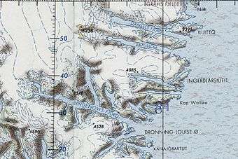
Nanuuseq, formerly known as Oyfjord, is a short fjord lying between Nattoralik to the north and Lindenow Fjord to the south. It extends in a roughly east/west direction from its mouth in the North Atlantic Ocean for about 20 km until its head. Its entrance is on the northern side of Nanuuseq Island and there is another 5 km long and narrow island within the fjord itself close to its northern shore. Noret is a short tributary fjord branching northwards off the western end of the long island.[4]
In the same manner as in the fjords further north, dark-hued mountains rise steeply from the shore on both sides. However, there are no glaciers reaching down to the waterline.[1]
See also
References
- 1 2 GoogleEarth
- ↑ Den grønlandske Lods - Geodatastyrelsen
- ↑ Prostar Sailing Directions 2005 Greenland and Iceland Enroute, p. 100
- ↑ "Nanûseq Fjord". Mapcarta. Retrieved 2 June 2016.
External links
- Den grønlandske Lods - Sejladsanvisninger Østgrønland
- Ketilidian structure and the rapakivi suite between Lindenow Fjord and Kap Farvel, South-East Greenland
- The Ketilidian orogen of South Greenland: geochronology, tectonics, magmatism, and fore-arc accretion during Palaeoproterozoic oblique convergence