Nansemond County, Virginia
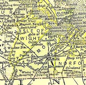
Nansemond is an extinct locality that was located in Virginia Colony and the Commonwealth of Virginia (after statehood) in the United States, from 1646 until 1974. It was Nansemond County until 1972, and the independent city of Nansemond from 1972 to 1974. It is now part of the independent city of Suffolk.
It was named for the Nansemond, a tribe of Native Americans, who have lived along the Nansemond River before the time the English colonists established Jamestown began arriving in 1607 and through to the present day.
History
17th Century
Under the Virginia Company of London, in 1619, the area which became Nansemond County was included in Elizabeth Cittie [sic], one of four large "boroughs", or "incorporations". In 1624, the Virginia Company lost its proprietary charter, and Virginia became a royal colony.
In 1634, the King of England directed the formation of eight shires (or counties) in the colony. One of these was Elizabeth River Shire, which included land area on both sides of Hampton Roads, as had the earlier Elizabeth Cittie. Two years later, New Norfolk County was formed in 1636 from Elizabeth River Shire. It included all the area in South Hampton Roads now incorporated in the five independent cities located there in modern times. The following year, in 1637, New Norfolk County was divided into Upper Norfolk County and Lower Norfolk County. Upper Norfolk County was officially redesignated the County of Nansimum by the House of Burgesses in March 1646; by the October session, this was also being spelled as Nansimund.
18th Century
In the 1720s, John Constant settled along the Nansemond river (in what is now Suffolk) and built a home, wharf, and warehouse. Thus the site became known as "Constant's Warehouse." [1]
Under the Tobacco Inspection Act of 1730, three of the 40 tobacco inspection warehouses were chartered in Nansemond County, under two inspectors, as follows:
At Waynwright's Landing, Isle of Wight; and Laurence's, in Nansemond County, under one inspection.
At the widow Constance's [sic], at Sleepy-Hole Point, in Nansemond County, under one inspection.[2]
In 1742, the Virginia House of Burgesses chartered a new town at Constant's Wharf and renamed it Suffolk.[3]
In 1750, the county seat of Nansemond County was moved from Jarnigan's or Cohoon's Bridge to Suffolk, a new town which had been formed at Constance's Warehouse at Sleepy Hole Point on the Nansemond River in 1742. It was named for the English hometown of Royal Governor William Gooch.
19th Century
Suffolk became an incorporated town in 1808 and an independent city in 1910. Even after Suffolk became politically independent of Nansemond County, the county seat and courts remained at Suffolk.
20th Century
| Year | Republican | Democratic | Third Parties |
|---|---|---|---|
| 1972 | 57.9% 5,767 | 39.4% 3,929 | 2.7% 270 |
| 1968 | 20.9% 2,101 | 41.6% 4,174 | 37.5% 3,758 |
| 1964 | 34.9% 2,590 | 64.8% 4,804 | 0.3% 21 |
| 1960 | 25.3% 1,346 | 74.1% 3,944 | 0.6% 33 |
| 1956 | 40.2% 1,753 | 57.2% 2,492 | 2.6% 115 |
| 1952 | 32.9% 1,168 | 66.4% 2,360 | 0.7% 25 |
| 1948 | 14.9% 413 | 76.3% 2,115 | 8.8% 245 |
| 1944 | 20.1% 351 | 79.9% 1,398 | |
| 1940 | 8.4% 129 | 91.6% 1,408 | 0.1% 1 |
| 1936 | 10.6% 175 | 89.4% 1,478 | 0.1% 1 |
| 1932 | 13.4% 196 | 86.2% 1,264 | 0.4% 6 |
| 1928 | 46.8% 649 | 53.2% 737 | |
| 1924 | 15.2% 99 | 82.7% 539 | 2.1% 14 |
| 1920 | 26.1% 243 | 74.0% 690 | |
| 1916 | 9.6% 70 | 90.5% 663 | |
| 1912 | 8.0% 53 | 81.6% 544 | 10.5% 70 |
As part of a wave of political consolidations in southeastern Virginia between 1952 and 1976, the unincorporated areas of Nansemond County merged with the outlying incorporated towns of Holland and Whaleyville to form the independent city of Nansemond. Only two years later, however, Nansemond merged with Suffolk to form the present-day city of Suffolk.[5] The end result was a new municipality encompassing a total of 430 square miles (1,100 km2), making it the largest city in Hampton Roads and in all of Virginia in land area and the 11th largest in the United States. With a life of 18 months, Nansemond was the shortest-lived independent city of any in Virginia.
References
- ↑ http://www.markerhistory.com/early-history-of-suffolk-marker-k-251/
- ↑ https://www.gutenberg.org/files/27117/27117-8.txt
- ↑ http://hamptonroads.com/2012/01/whats-name-constants-wharf-suffolk
- ↑ http://uselectionatlas.org/RESULTS
- ↑ http://historical-county.newberry.org/website/Virginia/documents/VA_Consolidated_Chronology.htm#Consolidated_Chronology Archived 2009-07-27 at the Wayback Machine.
Neighborhoods and municipalities of Suffolk, Virginia | ||
|---|---|---|
| Boroughs |  | |
| Neighborhoods | ||
External links

Coordinates: 36°44′22″N 76°36′34″W / 36.739323°N 76.609379°W