Naguabo, Puerto Rico
| Naguabo, Puerto Rico | ||
|---|---|---|
| Municipality | ||
| ||
| Nickname(s): Cuna de Grandes Artistas, Los Enchumbaos | ||
| Anthem: "Hacia el este de las Islas Antillanas" | ||
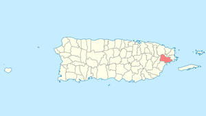 Location of Naguabo in Puerto Rico | ||
| Coordinates: 18°13′10″N 65°44′12″W / 18.21944°N 65.73667°WCoordinates: 18°13′10″N 65°44′12″W / 18.21944°N 65.73667°W | ||
| Country | United States | |
| Territory | Puerto Rico | |
| Founded | July 15, 1821 | |
| Government | ||
| • Mayor | Noé Marcano (PNP) | |
| • Senatorial dist. | 7 - Humacao | |
| • Representative dist. | 35 | |
| Area | ||
| • Total | 60.1 sq mi (155.57 km2) | |
| • Land | 52.1 sq mi (135 km2) | |
| • Water | 7.9 sq mi (20.57 km2) | |
| Population (2010) | ||
| • Total | 26,720 | |
| • Density | 440/sq mi (170/km2) | |
| Demonym(s) | Naguabeños | |
| Time zone | UTC−4 (AST) | |
| Zip code | 00718, 00744 | |
Naguabo (Spanish pronunciation: [naˈɣwaβo]) is a municipality in Puerto Rico (U.S.) located in the east coast of the island, north of Humacao; south of Río Grande and Ceiba; and east of Las Piedras. Naguabo is spread over 8 wards and Naguabo Pueblo (The downtown area and the administrative center of the city). It is part of the San Juan-Caguas-Guaynabo Metropolitan Statistical Area.
Naguabo is said to be the birthplace of the pastelillo de chapín, which is a popular food in Puerto Rico. It is trunkfish wrapped inside a flour dough that is deep fried. Pastelillo de chapín can be found in almost any seaside establishment on the island.
Geography
Naguabo is located in the southeast region of Puerto Rico. The northern part is within the Luquillo Mountain Range, which contain the Picos (tips) of the Este and the Oeste, at 3,448 and 3,346 feet (1,051 and 1,020 m) of altitude above sea level, respectively.[1]
Cityscape
Barrios
- Daguao
- El Duque
- Húcares
- Santiago y Lima
- Maizales
- Mariana
- Peña Pobre
- Florida
- Río Blanco
- Pueblo
- Rio (Brazo Seco)
Tourism
Landmarks and places of interest
- Algodones Key
- El Yunque National Forest (South Side via PR State Road 191 - Closed at KM 13 (mile marker 8.1) (approx.) due to Road Closure)
- Naguabo Beach
- Punta Lima Beach
- Ramón Rivero "Diplo" Monument
- Tropical Beach
- Yudelmi Center
- Pedro Flores Monument
- Hucares Waterfront (El Malecón - Boardwalk)
- City Square (Plaza De Recreo)
Culture
Festivals and events
- Maratón Cervecero En Naguabo -January http://www.miagendapr.com/event/maraton-cervecero-en-naguabo-2018/
- Chapín Festival - February
- Pedro Flores Week - March
- Diplo Festival - June
- Virgen del Carmen Fiesta - July 16
- Patron Saint Festival - October 7
Transportation
There is public transportation in Naguabo. It operates from 6:00 a.m. using the "Pisicorre" bus.
Books about Naguabo
Historia de Naguabo by Carmelo Rosario Natal
See also
- List of Puerto Ricans
- History of Puerto Rico
- Did you know-Puerto Rico?
References
- ↑ "Barrios de Puerto Rico: Barrio Daguao de Naguabo". PBS Learning Media. Florida PBS. Retrieved 27 November 2017.