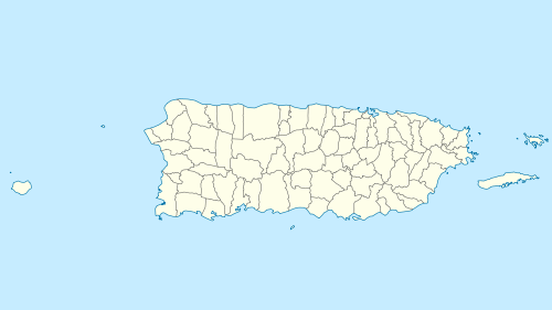
Monito Island
 Monito Island, Puerto Rico | |
 Monito | |
| Geography | |
|---|---|
| Coordinates | 18°9′29″N 67°56′47″W / 18.15806°N 67.94639°W |
| Area | .147 km2 (0.057 sq mi) |
| Highest elevation | 65 m (213 ft) |
| Administration | |
|
United States | |
| Commonwealth | Puerto Rico |
| Municipality | Mayagüez |
| Barrio | Isla de Mona e Islote Monito |
| Demographics | |
| Population | 0 |
| Pop. density | 0 /km2 (0 /sq mi) |
| Designated | 1975 |
Monito Island (‘Little Mona') (Spanish: Islote Monito) is an uninhabited island about 3.1 miles (5 kilometers) northwest of the much larger Mona Island. Monito is the masculine diminutive form of Mona in Spanish. It is one of three islands in the Mona Passage, and part of the Isla de Mona e Islote Monito barrio, a subdivision of the municipality of Mayagüez, Puerto Rico. It is inaccessible by sea and is barren. It reaches 213 ft (65 m) in height and measures 0.06 sq mi (0.16 km2) or 36.25 acres (14.67 hectares) in area.
Gallery
- Monito as seen from dive boat, just a large rock in the ocean.
 Banded Coral Shrimp
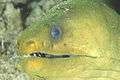 Green Moray Eel
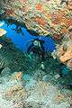 Diver in cave
 Diver and anemone
 Diver and old anchor
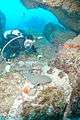 Diver and Nurse Shark in cave at Monito
References
- Monito Island: Block 1041, Block Group 1, Census Tract 815.12, Mayagüez Municipio, United States Census Bureau
- Monito Island summary from the University of Puerto Rico-Mayagüez Department of Biology Herbarium
Coordinates: 18°09′30″N 67°56′48″W / 18.158208°N 67.94662°W
This article is issued from
Wikipedia.
The text is licensed under Creative Commons - Attribution - Sharealike.
Additional terms may apply for the media files.