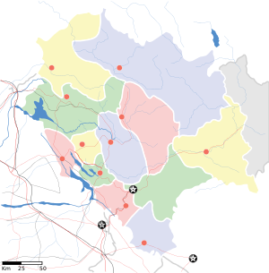
Nagarota Surian
| Nagrota Surian | |
|---|---|
| Village | |
 Nagrota Surian  Nagrota Surian | |
| Coordinates: 32°03′18″N 76°05′24″E / 32.055°N 76.090°ECoordinates: 32°03′18″N 76°05′24″E / 32.055°N 76.090°E | |
| Country |
|
| State | Himachal Pradesh |
| District | Kangra |
| Elevation | 455 m (1,493 ft) |
| Languages | |
| • Official | Hindi |
| Time zone | UTC+5:30 (IST) |
Nagrota Surian is a town in Nagrota Surian Mandal, Kangra District, in the Indian state of Himachal Pradesh. Nagrota Surian is 45.2 km from the district headquarters Dharamshala. It is about 260 km from the state capital Shimla.
Nearest towns
Nearby villages include Katholi (1.1 km), Bassa (1 km), Amlela (1.9 km), Khabbal (2 km), Jarot (2.2 km), and Katora (2.3 km). Nearest towns are Nagrota Surian (0 km), Masrrur Temple (7 km), Dehra Gopipur (28 km) and Kangra.
Places of interest
This town is located near the Pong Lake. The Pong Dam Reservoir is very much approachable from Nagrota Surian, which is the main attraction due to migratory birds during various seasons. This reservoir is come under the Ramsar Wetland sites.and rancer an small island between pong dam,approachable by boat.it consist of some local wild animals and a pathway circling full island and offer great view of the dam.
Transportation to Nagarota Surian
- Nearest airport is Kangra Airport in Gaggal, 36 km away.
- By bus from Nurpur 60 km, from Dehra 28 km
- from Kangra 44 km, from Dharmshala 45 km, and 68 km from Palampur
Nearest railway station
- Nagrota Surian 0 km, i.e., on narrow gauge b/w Pathankot to Jogindernagar
Education
Schools:
- Adarsh Bharti Public School
- D.A.V Sen SecPublic School
- Govt. Sen. Sec. School
- Galaxy Public School(Affiliated to CBSE)
- Shivalik Public School
- S.V.M Public School
- Saint Rudraksh School
- Govt. Primary School(English Medium)
- Govt. degree college