Nafanga
| Nafanga | |
|---|---|
| Commune | |
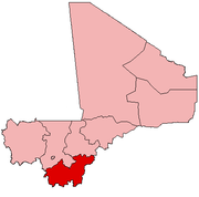
 Nafanga Location in Mali | |
| Coordinates: 12°16′54″N 5°15′28″W / 12.28167°N 5.25778°WCoordinates: 12°16′54″N 5°15′28″W / 12.28167°N 5.25778°W | |
| Country |
|
| Region | Sikasso Region |
| Cercle | Koutiala Cercle |
| Area[1] | |
| • Total | 274 km2 (106 sq mi) |
| Population (2009)[2] | |
| • Total | 9,273 |
| • Density | 34/km2 (88/sq mi) |
| Time zone | UTC+0 (GMT) |
Nafanga is a rural commune in the Cercle of Koutiala in the Sikasso Region of southern Mali. The commune covers an area of 274 square kilometers and includes 6 villages.[3]
%2CML_sat12apr2014-0932h.jpg)
Village scene at Kani (Nafanga Commune), April 2014
%2Csign(Cooperative_'_'_Bengkadi'_'_de_Dougouniona)_Nintabougoro_vlge(Nafanga_Cmn.%2CKoutiala_Crc.%2CSikasso_Rgn)%2CML_fri24apr2015-1043h.jpg)
Village scene at Nintabougoro (Nafanga Commune), April 2015
- Dougouniona
- Kani
- Karangasso
- Nintabougoro
- Tianhirisso
- Zéguésso
In the 2009 census it had a population of 9,273.[2] The village of Karangasso, the administrative centre (chef-lieu) of the commune, is 26 km southeast of Koutiala.
References
- ↑ Common and Fundamental Operational Datasets Registry: Mali, United Nations Office for the Coordination of Humanitarian Affairs . commune_mali.zip (Originally from the Direction Nationale des Collectivités Territoriales, République du Mali)
- 1 2 Resultats RGPH 2009 (Région de Sikasso) (PDF) (in French), République de Mali: Institut National de la Statistique, archived from the original on 19 September 2012 .
- ↑ Communes de la Région de Sikasso (PDF) (in French), Ministère de l’administration territoriale et des collectivités locales, République du Mali, archived from the original on 19 September 2012 .
External links
- Plan de Sécurité Alimentaire Commune Rurale de Nafanga 2006-2008 (PDF) (in French), Commissariat à la Sécurité Alimentaire, République du Mali, USAID-Mali, 2006 .
This article is issued from
Wikipedia.
The text is licensed under Creative Commons - Attribution - Sharealike.
Additional terms may apply for the media files.