Nadine, New Mexico
| Nadine, New Mexico | |
|---|---|
| Unincorporated community | |
 Nadine | |
| Coordinates: 32°37′26″N 103°07′39″W / 32.62389°N 103.12750°WCoordinates: 32°37′26″N 103°07′39″W / 32.62389°N 103.12750°W | |
| Country | United States |
| State | New Mexico |
| County | Lea |
| Area[1] | |
| • Total | 11.803 sq mi (30.57 km2) |
| • Land | 11.798 sq mi (30.56 km2) |
| • Water | 0.005 sq mi (0.01 km2) |
| Elevation | 3,602 ft (1,098 m) |
| Population (2010)[1] | |
| • Total | 376 |
| • Density | 32/sq mi (12/km2) |
| Time zone | UTC-7 (Mountain (MST)) |
| • Summer (DST) | UTC-6 (MDT) |
| Area code(s) | 575 |
| GNIS feature ID | 938793[2] |
Nadine is an unincorporated community and census-designated place in Lea County, New Mexico, United States. Its population was 376 as of the 2010 census.[1] New Mexico State Road 18 passes through the community.
Geography
Nadine is located at 32°37′26″N 103°07′39″W / 32.6240031°N 103.1274236°W.[2] According to the U.S. Census Bureau, the community has an area of 11.803 square miles (30.57 km2); 11.798 square miles (30.56 km2) of its area is land, and 0.005 square miles (0.013 km2) is water.[1]
References
- 1 2 3 4 "2010 Census Gazetteer Files - Places: New Mexico". U.S. Census Bureau. Retrieved December 23, 2016.
- 1 2 "Nadine". Geographic Names Information System. United States Geological Survey.
Municipalities and communities of Lea County, New Mexico, United States | ||
|---|---|---|
| Cities | 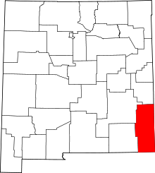 | |
| Town | ||
| CDPs | ||
| Other unincorporated communities | ||
This article is issued from
Wikipedia.
The text is licensed under Creative Commons - Attribution - Sharealike.
Additional terms may apply for the media files.