Mytholmroyd
| Mytholmroyd | |
|---|---|
 View of Mytholmroyd from the north | |
 Mytholmroyd Mytholmroyd shown within West Yorkshire | |
| Population | 3,949 (2011)[1] |
| OS grid reference | SE012260 |
| Civil parish | |
| Metropolitan borough | |
| Metropolitan county | |
| Region | |
| Country | England |
| Sovereign state | United Kingdom |
| Post town | HEBDEN BRIDGE |
| Postcode district | HX7 |
| Dialling code | 01422 |
| Police | West Yorkshire |
| Fire | West Yorkshire |
| Ambulance | Yorkshire |
| EU Parliament | Yorkshire and the Humber |
| UK Parliament | |
Mytholmroyd /ˈmaɪðəmrɔɪd/ pronounced "My-Thom-Royd" is a large village in Hebden Bridge, West Yorkshire, England, 10 miles (16.1 km) east of Burnley and 7 miles (11.3 km) west of Halifax. The village is in the Luddendenfoot Ward of Calderdale Council and forms part of the Hebden Royd parish.[2]
Etymology
Mytholmroyd was recorded in the 13th century as "Mithomrode" and in the 17th century as "Mitholmroide". The name means 'a clearing for settlement, where two rivers meet', likely derived from the Old English (ge)mȳthum (inflected form of (ge)mȳthe, "river mouth"), plus rodu ("field" or "clearing"). The l was probably inserted out of confusion with the common place-name element holm, Old Norse for a small island or eyot.[3][4]
History
A Bronze Age urnfield exists on the moor top, north of Mytholmroyd. It is a burial ground with cremation urns, dating between the 16th and 11th centuries BC of national importance. Evidence of pre-historic farming is apparent because they cleared the upland forests for cattle grazing and created the peat moorlands. Most of the Celtic Iron Age settlements were concentrated on the hillside terraces which avoided the wooded and poorly drained valley floors. Most of the older listed buildings are located on the hillsides away from the valley. A Roman coin hoard has been found to the south of Mytholmroyd.[5]
Cragg Coiners
During the late 18th century, the valley to the south, known as Cragg Vale, was home to a gang of counterfeiters known as the Cragg Coiners. The gang's leader, David Hartley, or King David as he was known, was found guilty of the 1769 murder of excise official William Dighton and was hanged at the York Tyburn on 28 April 1770. Two other gang members were also executed for their part in the murder.
Historic buildings and structures
Canalside Mill
Built in 1851 as Canal Wharf Mill, it was home to local company Walkley Clogs, and converted into a well known tourist attraction with cafes, shops and an open clog factory on the ground floor. It was destroyed by fire in the 1990s; consequently the top floor was demolished and re-opened under ownership of a property development company. It subsequently closed in 2002 and has since been boarded up. Numerous planning applications to continue its former use or convert it into luxury apartments have been passed but never undertaken.[6]
St. Michael's Church
The parish church was built in 1847 in Early English style. It was badly damaged in the 2015 floods but has since re-opened. The Sunday school in front of the church was reduced to one storey and is now used as a community hall and meeting spaces available for hire. In 2009 a new town square complete with monument was constructed in the church car park and is now used for markets and events.
County Bridge
There has been a river crossing point since 1329 in the centre of the village, at the site of the current 'County Bridge'. A bridge is recorded in this location under the name "Elphaborough Bridge", after the name of Elphaborough Hall on the further side of Cragg Brook. Records of a grant issued to the local township for the purchase of timber stated it was for "repairs to Mitholmroide Bridge", in 1638. Similar records show that the current stone bridge was erected in 1684 by Timothy Wadsworth, at a cost of £50. The current bridge was constructed in two parts (and now consists of four extensions). The original packhorse style bridge in 1638, and on the upstream side, the bridge was widened and two extra arches on the south end were added to ease the gradient, although the two new arches were considerably smaller, the bridge now consists of four arches in total. In the 19th century, with shops being constructed on the north end riverbank, and a new premises being built for the Mytholmroyd Co-Operative Society right up to the water's edge on the south bank, two of the bridge's arches are mostly hidden. However, the premises were built with a large opening underneath the buildings, allowing floodwater to still pass through the two hidden arches underground. Mytholmroyd Bridge was eventually taken over by West Riding County Council, which gives the historic bridge its present name of "County Bridge".[7]
Railway station and viaduct
A prominent viaduct lies above the southern end of Mytholmroyd town centre. It was erected in 1840 by George Stephenson and is still in use as part of the modern day Calder Valley Line. In the 1850s, Mytholmroyd railway station was built, consisting of two platforms built on the Mytholmroyd Viaduct, and a three-storey ticket office, waiting hall and entrance stairwell, leading unto the viaduct. This later closed and the platforms were built a matter of yards up the track on land, and is now accessed by open staircases and long access ramps up the steep banking, where flowers and displays are maintained by the Mytholmroyd Station Partnership.
Dusty Miller Inn
This late 18th century pub replaced an earlier inn on the opposite side of the road, where Bridge End cottages now stand. The earlier building was home to the Cragg Coiners in 1769. The current Grade II-listed inn comprises a hotel, bar and restaurant. The premises were severely damaged in the 2012 and 2015 flooding, causing the business to close for repairs. The bar re-opened in April 2016 and was awarded the "pub of the season award" for summer 2016 by the local CAMRA branch.[8] As of February 2017 the hotel and restaurant are yet to re-open.[9]
Redacre House
Redacre House, off Burnley Road, dates from the late 16th century, and is probably the earliest house in Calderdale exhibiting an F-plan formed by the projecting two-storey porch and crosswing.[5]
Mytholmroyd today
Mytholmroyd now is a designated conservation area, with more than 21 listed buildings in the centre alone. The village is located approximately 1 mile (1.6 km) from the centre of Hebden Bridge, and is often known to locals as 'Royd'. The population is roughly 4,000. The village holds markets, performances at the St. Michael's Enterprise Centre, antique shows and fairs, together with events at the sports and leisure centre and at the Ted Hughes Theatre.[10] Mytholmroyd has many business parks and a high street in the centre with mainly independent shops including a gift shop, garden shop, post office, sweet shop, hardware shop, travel centre, launderette, hair salons and takeaways. There are also many eating venues including Aux Delices Bistro & Wine Bar, the Blue Teapot bistro, Riverside Cafe, the Shoulder of Mutton and more. There is a medical complex including a dental practice, pharmacy, health centre, opticians and more.
The village is currently (2017/18) under development with the Environment Agency's Mytholmroyd Flood Alleviation Scheme. This includes raising the height of flood walls on the banks of the River Calder and Cragg Brook, as well as demolishing homes and businesses on the Calder's banks to widen the river. The village's post office has been relocated to flood-proof premises, with other buildings being stabilised and strengthened. Caldene Bridge, upstream from County Bridge, is to be demolished and relocated as well as the bridge at Greenhill Industrial Estate.
Flooding
2015
Mytholmroyd was severely affected by the Boxing Day floods in 2015, when the River Calder and the canal both rose to cover the valley floor, and consequently the town centre of Mytholmroyd. It was the highest ever recorded river level. Hundreds of homes and businesses were devastated, with some buildings still empty in 2017. The row of shops north of County Bridge partially collapsed into the river, and £10 million was earmarked for future protection of the village. The whole row of shops which partially collapsed have been fully demolished, along with homes along the riverbank at Calder Grove. Russell Dean Furnishers are re-building (completion due 2018) their furniture showroom above ground level and in 2018 the Co-op Food commenced rebuilding its premises.
2012
A flash flood occurred in July 2012, when a downpour lasting just 90 minutes devastated the village. This was a repeat of another flash flood of June, in the same year, where more than 50 mm of rain fell causing the River Calder to burst its banks. More than 5,000 properties were severely damaged in the Upper Calder Valley; many businesses lost insurance and consequently many never recovered.
1954
On Saturday, 21 August 1954, almost 8 years since the devastating 1946 flood, a flash flood devastated the village once again; the river rose by more than 6 ft in less than two hours, with flood water entering properties at over 2 ft every 15 minutes. The Dusty Miller Inn had almost 4 ft of water in its bar area. Flood alleviation works in the 1960s uncovered that County Bridge was standing on foundations untouched since the wooden bridge 17th century, so as part of the works the bridge's foundations were quickly filled with concrete.
1946
In the worst flooding to ever affect the village, many properties suffered flood water up to the second storey, and the village remained underwater for almost 12 hours. Two shops on Burnley Road collapsed into the river, shops just doors down from the buildings that collapsed in the 2015 flood. By 8 am, flood waters reached up to 7 feet.
1837
A disastrous flood occurred in 1837; few details are known about it, although it is known that the river reached the height of the canal, built on the hillside, and ultimately overflowed it.[11]
Gallery
 St. Michael's Church, Mythomroyd
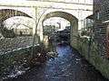 Elphin Brook passing under the Caldervale Line railway viaduct
.jpg) New Road passing under the Caldervale Line railway viaduct
New Road passing under the Caldervale Line railway viaduct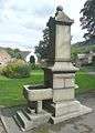 Drinking fountain, off Cragg Road
 Gorillas next to the Rochdale Canal
.jpg) Last colours of autumn, Mytholmroyd (7 November 2010)
Last colours of autumn, Mytholmroyd (7 November 2010)
Education
Mytholmroyd is the home of Calder High School,[12] the largest Comprehensive School in the Upper Calder Valley. It is also home to Scout Road Academy and Burnley Road Academy. In 2016, plans were announced by Calderdale Council to re-locate Cragg Vale School into Calder High School's sixth form, with a new sixth form centre to be built on fields to the rear of the school, on a larger scale, to incorporate the recently closed Todmorden Sixth Form.
Culture
Mytholmroyd Community Centre[13] hosts the annual Dock Pudding Championships, in April. In 2007 Robbie Coltrane entered the competition and was awarded second place.[14]
The 130-foot (40 m) Scout Rock on the south side of the valley in Mytholmroyd features heavily in Ted Hughes' autobiography, The Rock. Hughes was born in the village, before moving to Mexborough, but latterly owned a property in Mytholmroyd in his adulthood. Hughes claimed that Scout Rock cast its mood over the village.[15]
Transport
Rail
The village is served by Mytholmroyd railway station, located on New Road, Northern operate a two per-hour service between Leeds and Manchester. However, more frequent services from Hebden Bridge are often used by Mytholmroyd residents, with direct services to Blackpool, Manchester, York, Leeds, Burnley, Rochdale and more. The Calder Valley Line railway was completed in 1841 but there was no station at Mytholmroyd which shows how few people lived here in 1840.[16]
Road
The village has two main bus stops in the village centre—recently equipped with departure screens, new shelters, toilets and seating. Local bus services are shared between TLC Travel (operating the 597, 900 and 901) and First West Yorkshire (operating the 590 and 592), which serve the village. There is a large taxi rank based in the village and also cycling is very popular in the area since recent investment including the resurfacing of the Rochdale Canal and Route 66 Cycleway and Le Tour de France passing through the village. The Tour de Yorkshire now also passes through the village, including Cragg Vale, also in Mytholmroyd, the longest continuous climb in the country- and also the longest line of bunting hung from the bottom to the top of the road, this was verified in 2014 by the Guinness Book of World Records.
Air
Leeds Airport is accessible by rail and bus from Mytholmroyd.
Governance
The village is part of the Luddendenfoot ward of the Metropolitan borough of Calderdale, part of the Metropolitan county of West Yorkshire.[17]
At a district level Mytholmroyd Urban District Council was set up in 1894. In 1937 it merged with Hebden Bridge Urban District Council to become Hebden Royd Urban District Council. At a county level Mytholmroyd was administered by the West Riding County Council. Both of these were abolished as part of the reforms introduced in the Local Government Act 1972. They were replaced with West Yorkshire Metropolitan County Council and Calderdale Metropolitan Borough Council. The Hebden Royd Town Council area forms a civil parish. West Yorkshire County Council was abolished in 1986, leaving Mytholmroyd with represented at borough and town council level.
Notable people
- Eric Harrison, footballer
- Ted Hughes, British Poet Laureate
- Innes Ireland, racing driver and Grand Prix winner
- Jane Lumb, actress and fashion model
References
- ↑ "Mytholmroyd (West Yorkshire, Yorkshire and the Humber, United Kingdom) - Population Statistics and Location in Maps and Charts". CityPopulation.de. Retrieved 5 February 2017.
- ↑ "Hebden Royd Council". 2017. Retrieved 1 January 2017.
- ↑ Mills, Anthony David (2003). Oxford dictionary of British place names. Oxford University Press. p. 513.
- ↑ Goodall, Armitage (1913). Place-names of South-West Yorkshire. Cambridge University Press. p. 216.
- 1 2 "Mytholmroyd Conservation Area Appraisal" (PDF). Calderdale Council. p. 3. Retrieved 11 January 2017.
- ↑ "Malcolm Bull's Calderdale Companion : Mills & Mines : C". Ancestry.com. Retrieved 5 February 2017.
- ↑ Sunderland, M. (December 2003). It's water under the bridge!. p. 40.
- ↑ "Pub of the Season, Summer 2016: The Dusty Miller" (PDF). CalderCask. No. 39. Halifax and Calderdale branch of the CAMRA. p. 9. Retrieved 7 February 2017.
- ↑ "The Dusty Miller Inn". Retrieved 7 February 2017.
- ↑ "The Mytholmroyd Net Ted Hughes Memorial at Calder High School". Mytholmroyd.net. Retrieved 5 February 2017.
- ↑ "Eye On Calderdale". EyeOnCalderdale.com. Retrieved 5 February 2017.
- ↑ Calder High
- ↑ "すっきりフルーツ青汁を楽天やAmazonより最安値でGET!【注目】". MytholmroydCommunityAssociation.co.uk. Retrieved 5 February 2017.
- ↑ "Hebweb news 2007: Robbie Coltrane comes 2nd in World Dock Pudding championship". Hebden Bridge Web. Retrieved 20 July 2014.
- ↑ "A walk around Ted Hughes' Mytholmroyd". BBC.co.uk. Retrieved 19 July 2016.
- ↑ "Mytholmroyd Conservation Area Appraisal" (PDF). Calderdale Council. p. 2. Retrieved 11 January 2017.
- ↑ "Luddendenfoot". 2010. Retrieved 20 January 2014.
External links
| Wikimedia Commons has media related to Mytholmroyd. |