Myre, Øksnes
| Myre | |
|---|---|
| Village | |
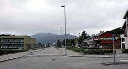 Myre's main street | |
 Myre Location in Nordland  Myre Myre (Norway) | |
| Coordinates: 68°54′50″N 15°04′42″E / 68.91389°N 15.07833°ECoordinates: 68°54′50″N 15°04′42″E / 68.91389°N 15.07833°E | |
| Country | Norway |
| Region | Northern Norway |
| County | Nordland |
| District | Vesterålen |
| Municipality | Øksnes |
| Area[1] | |
| • Total | 1.61 km2 (0.62 sq mi) |
| Elevation[2] | 11 m (36 ft) |
| Population (2013)[1] | |
| • Total | 2,054 |
| • Density | 1,276/km2 (3,300/sq mi) |
| Time zone | UTC+01:00 (CET) |
| • Summer (DST) | UTC+02:00 (CEST) |
| Post Code | 8430 Myre |
Myre is the administrative centre of the municipality of Øksnes in Nordland county, Norway. It is located on the northwestern part of the island of Langøya in the Vesterålen archipelago. Myre is one of the largest fishing villages in all of Norway. Myre Church is located in this village.
The 1.61-square-kilometre (400-acre) village has a population (2013) of 2,054. The population density of the village is 1,276 inhabitants per square kilometre (3,300/sq mi).[1][3]
The newspaper Øksnesavisa is published in Myre.[4]
References
- 1 2 3 Statistisk sentralbyrå (1 January 2013). "Urban settlements. Population and area, by municipality".
- ↑ "Myre" (in Norwegian). yr.no. Retrieved 2012-08-02.
- ↑ Store norske leksikon. "Myre" (in Norwegian). Retrieved 2012-08-02.
- ↑ Store norske leksikon: Øksnesavisa.
This article is issued from
Wikipedia.
The text is licensed under Creative Commons - Attribution - Sharealike.
Additional terms may apply for the media files.