Musweiler
| Musweiler | ||
|---|---|---|
| ||
 Musweiler Location of Musweiler within Bernkastel-Wittlich district 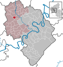 | ||
| Coordinates: 50°00′36″N 6°48′08″E / 50.01000°N 6.80222°ECoordinates: 50°00′36″N 6°48′08″E / 50.01000°N 6.80222°E | ||
| Country | Germany | |
| State | Rhineland-Palatinate | |
| District | Bernkastel-Wittlich | |
| Municipal assoc. | Wittlich-Land | |
| Government | ||
| • Ortsbürgermeister | Lothar Zens | |
| Area | ||
| • Total | 3.05 km2 (1.18 sq mi) | |
| Elevation | 330 m (1,080 ft) | |
| Population (2017-12-31)[1] | ||
| • Total | 59 | |
| • Density | 19/km2 (50/sq mi) | |
| Time zone | CET/CEST (UTC+1/+2) | |
| Postal codes | 54534 | |
| Dialling codes | 06575 | |
| Vehicle registration | WIL | |

Musweiler is an Ortsgemeinde – a municipality belonging to a Verbandsgemeinde, a kind of collective municipality – in the Bernkastel-Wittlich district in Rhineland-Palatinate, Germany.
Geography
Location
The municipality lies in the Eifel. The nearest large town is the district seat, Wittlich, some 6 km to the east. Musweiler belongs to the Verbandsgemeinde Wittlich-Land.
Neighbouring municipalities
Musweiler borders in the north on Großlittgen, in the east on Minderlittgen and Hupperath and in the south on Landscheid.
History
Musweiler’s moated castle was an Electoral-Trier fief held by the Lords of Manderscheid, who for a time further enfeoffed the Lords of Esch with their holding. Beginning in 1794, Musweiler lay under French rule. In 1814 it was assigned to the Kingdom of Prussia at the Congress of Vienna. Since 1947, it has been part of the then newly founded state of Rhineland-Palatinate.
Politics
Municipal council
The council is made up of 6 council members, who were elected by majority vote at the municipal election held on 7 June 2009, and the honorary mayor as chairman.[2]
Coat of arms
The municipality’s arms might be described thus: Argent on a mount in base vert a tower embattled on each of two floors gules between a spade and tongs, both palewise and azure.[3]
Economy and infrastructure
To the south runs Bundesstraße 60. In Wittlich is a railway station on the Koblenz-Trier railway line.
References
- ↑ Statistisches Landesamt Rheinland-Pfalz "Bevölkerungsstand 2017 - Gemeindeebene" Check
|url=value (help). Statistisches Landesamt Rheinland-Pfalz (in German). 2018. - ↑ Kommunalwahl Rheinland-Pfalz 2009, Gemeinderat
- ↑ Musweiler’s arms Archived 2010-03-23 at the Wayback Machine. Go to Ortsgemeinden> Musweiler.
External links
- Verbandsgemeinde of Manderscheid (in German)