Hetzerath
| Hetzerath | ||
|---|---|---|
| ||
 Hetzerath Location of Hetzerath within Bernkastel-Wittlich district 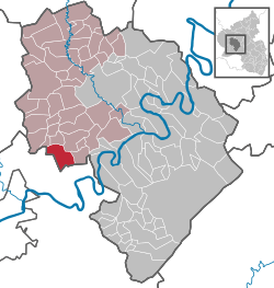 | ||
| Coordinates: 49°52′42″N 6°48′51″E / 49.87833°N 6.81417°ECoordinates: 49°52′42″N 6°48′51″E / 49.87833°N 6.81417°E | ||
| Country | Germany | |
| State | Rhineland-Palatinate | |
| District | Bernkastel-Wittlich | |
| Municipal assoc. | Wittlich-Land | |
| Government | ||
| • Mayor | Otmar Mischo | |
| Area | ||
| • Total | 13.87 km2 (5.36 sq mi) | |
| Elevation | 180 m (590 ft) | |
| Population (2017-12-31)[1] | ||
| • Total | 2,330 | |
| • Density | 170/km2 (440/sq mi) | |
| Time zone | CET/CEST (UTC+1/+2) | |
| Postal codes | 54523 | |
| Dialling codes | 06508 | |
| Vehicle registration | WIL | |

Hetzerath is an Ortsgemeinde – a municipality belonging to a Verbandsgemeinde, a kind of collective municipality – in the Bernkastel-Wittlich district in Rhineland-Palatinate, Germany.
Geography
Location
The municipality lies on the edge of the Southern Eifel in the Wittlich Depression between Wittlich and Trier, five kilometres away from the Moselle, and is therefore known in officialdom as “Hetzerath (Mosel)”. It belongs to the Verbandsgemeinde of Wittlich-Land, whose seat is in Wittlich, although that town is itself not in the Verbandsgemeinde.
History
In 893, Hetzerath had its first documentary mention as Salmana ("Homestead of the Salm"). In the 9th or 10th century the name was changed to Hecelroide ("Hezilo’s Clearing"). The oldest documentary mention after the name change comes from 1068. Beginning in 1794, Hetzerath lay under French rule. In 1814 it was assigned to the Kingdom of Prussia at the Congress of Vienna. Since 1947, it has been part of the then newly founded state of Rhineland-Palatinate.
Politics
Municipal council
The council is made up of 16 council members, who were elected by proportional representation at the municipal election held on 7 June 2009, and the honorary mayor as chairman.
The municipal election held on 7 June 2009 yielded the following results:[2]
| SPD | CDU | FBL | WG Wagner | Total | |
| 2009 | 3 | 3 | 9 | 1 | 16 seats |
Coat of arms
The municipality’s arms might be described thus: Argent two bars in chief and as many in base azure surmounted by a cross gules, itself surmounted by a fleur-de-lis of the first.
Economy and infrastructure
In the village is a railway station on the Koblenz-Trier line. Landesstraße (State Road) 141 runs through the municipality’s full length.
A further economic factor is the Industriepark Region Trier (IRT) between Föhren and Hetzerath. Here, roughly 80 businesses are located, furnishing many jobs for the region, and also for Hetzerath.
References
- ↑ Statistisches Landesamt Rheinland-Pfalz "Bevölkerungsstand 2017 - Gemeindeebene" Check
|url=value (help). Statistisches Landesamt Rheinland-Pfalz (in German). 2018. - ↑ Kommunalwahl Rheinland-Pfalz 2009, Gemeinderat
External links