Mukerian
| Mukerian | |
|---|---|
| City | |
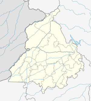
 Mukerian Location in Punjab, India | |
| Coordinates: 31°57′N 75°37′E / 31.95°N 75.62°ECoordinates: 31°57′N 75°37′E / 31.95°N 75.62°E | |
| Country |
|
| State | Punjab |
| District | Hoshiarpur |
| Population (2011)[1] | |
| • Total | 29,841 |
| Time zone | UTC+5:30 (IST) |
| PIN | 144211 |
| Telephone code | +01883 |
| Vehicle registration | PB54 |
| Website | Mcmukerian.com |
Mukerian is a city and municipal council of Hoshiarpur district in Punjab.
Geography
Mukerian is located at 31°57′N 75°37′E / 31.95°N 75.62°E.[2] It has an average elevation of 245 metres (803 feet).
Demographics
As of 2011 India census,[3] Mukerian city had a population of 29,841. Males constitute 52% of the population and females 48%. Mukerian has an average literacy rate of 77%, higher than the national average of 59.5%: male literacy is 80%, and female literacy is 74%. In Mukerian, 11% of the population is under 6 years of age.
Education
Army School Unchi Bassi is the first CBSE affiliated school in the area. Now there are many good schools in close vicinity of Mukerian, Victoria International School (CBSE) ,St. Joseph's Convent School (ICSE) and Dashmesh Public School (CBSE), MRD Sarvhitkari Vidya Mandir , Dashmesh Public School is under management of SGPC and both schools are situated in Mukerian in a colony named Chak Alla Bakesh.There are two degree colleges in the city – S.P.N College and Dashmesh Girls' College. Late Brig. Mehar Singh (retd) a patriot from Mukerian have been the chairperson of S.P.N College of nursing, (For ANM & GNM & B.Sc. Nursing and For PG) affiliated to Baba Farid University.The city has one Engineering college; S.B.C.M.S Institute Of Technology, Attalgarh and one Polytechnic college; Brahm Kamal Polytechnic College,
Points of interest
Mukerian Hydel Project is one of the biggest irrigation projects in India. The Pong Dam across river Beas is about 35 km from Mukerian. Mukerian is located on National Highway 44 and state highway 15 and about 450 km north of New Delhi. A Lord Shiva temple is in the village of Kathgarh/Mirthal, about 20 km from Mukerian city. There is a natural Shivling in the temple. There is another temple Dera Baba Kanaiya Gir Ji Maharaj located 7km from Mukerian in the village Harsa Kalota known by the saint Baba Kanaiya Gir Ji (Baba Bohran Walay).
Economy
Mukerian has some 23 rice mills. A few prominent ones are Chajju Ram Muni Lal Rice & General Mills (888 and Lal Mandir brands), located on G.T. Road opposite Sugar Mill. The sugar mill at the south of the city is one of the biggest sugar mills in Punjab. Mukerian Paper Ltd. is the industry and distillery is the major employer in the region.
Famous for its rice production across Punjab and across India, prominent Rice Mills now export their product all over the world. Basmati, Sharbati etc. are some of the better known varieties produced here in abundance.
Mukerian is one of the biggest tehsils in Punjab. There are a number of villages that come under it. Many villages like Taggar Kalan ,Dhoula Khera, Landay(Mohiuldinpur Gazi), Manjpur, Ladpur, Tanda Ram Sahai, Mansoorpur, [BehBal-Manj], Kasrawan Aima Mangat, Budhabarh, Purika, Pawar, etc. Most of the population is engaged in agriculture.
Distance from other cities
New Delhi = 450 km, Jalandhar = 74 km, Amritsar = 100 km, Ludhiana = 131 km, Dharmshala = 125 km, Chandigarh = 205 km, Hoshiarpur = 55 km, Dalhousie = 120 km.
References
- ↑ "Census of India Search details". censusindia.gov.in. Retrieved 10 May 2015.
- ↑ Falling Rain Genomics, Inc – Mukerian
- ↑ "Census of India 2001: Data from the 2001 Census, including cities, villages and towns (Provisional)". Census Commission of India. Archived from the original on 2004-06-16. Retrieved 2008-11-01.