Mueang Prachinburi District
| Mueang Prachinburi เมืองปราจีนบุรี | |
|---|---|
| Amphoe | |
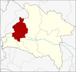 Amphoe location in Prachinburi Province | |
| Coordinates: 14°3′2″N 101°22′0″E / 14.05056°N 101.36667°ECoordinates: 14°3′2″N 101°22′0″E / 14.05056°N 101.36667°E | |
| Country | Thailand |
| Province | Prachinburi |
| Area | |
| • Total | 451.896 km2 (174.478 sq mi) |
| Population (2005) | |
| • Total | 106,239 |
| • Density | 235.1/km2 (609/sq mi) |
| Time zone | UTC+7 (ICT) |
| Postal code | 25000 |
| Geocode | 2501 |
Mueang Prachinburi (Thai: เมืองปราจีนบุรี, RTGS: mueang prachinburi, pronounced [mɯ̄a̯ŋ prāː.t͡ɕīːn bū.rīː]) is the capital district (amphoe mueang) of Prachinburi Province, eastern Thailand.
Geography
Neighboring districts are (from the east clockwise) Prachantakham, Si Maha Phot, Si Mahosot, and Ban Sang of Prachinburi Province, and Pak Phli of Nakhon Nayok Province.
Administration
The district is divided into 13 sub-districts (tambon), which are further subdivided into 144 villages (muban). Prachinburi is a town (thesaban mueang) which covers the whole tambon Na Mueang. There are two townships (thesaban tambon). Ban Na Prue covers parts of tambon Noen Hom, and Khok Makok covers parts of tambon Non Hom. There are a further 12 tambon administrative organizations (TAO).
| No. | Name | Thai name | Villages | Pop. | |
|---|---|---|---|---|---|
| 1. | Na Mueang | หน้าเมือง | - | 19,910 | |
| 2. | Rop Mueang | รอบเมือง | 9 | 6,092 | |
| 3. | Wat Bot | วัดโบสถ์ | 11 | 2,922 | |
| 4. | Bang Decha | บางเดชะ | 9 | 3,143 | |
| 5. | Tha Ngam | ท่างาม | 12 | 4,720 | |
| 6. | Bang Boribun | บางบริบูรณ์ | 6 | 1,296 | |
| 7. | Dong Phraram | ดงพระราม | 12 | 12,703 | |
| 8. | Ban Phra | บ้านพระ | 19 | 15,396 | |
| 9. | Khok Mai Lai | โคกไม้ลาย | 7 | 3,977 | |
| 10. | Mai Khet | ไม้เค็ด | 12 | 11,342 | |
| 11. | Dong Khilek | ดงขี้เหล็ก | 14 | 9,640 | |
| 12. | Noen Hom | เนินหอม | 20 | 9,304 | |
| 13. | Non Hom | โนนห้อม | 13 | 5,794 |