Na Di District
| Na Di นาดี | |
|---|---|
| Amphoe | |
.jpg) | |
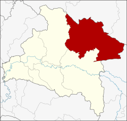 Amphoe location in Prachinburi Province | |
| Coordinates: 14°6′36″N 101°47′6″E / 14.11000°N 101.78500°ECoordinates: 14°6′36″N 101°47′6″E / 14.11000°N 101.78500°E | |
| Country | Thailand |
| Province | Prachinburi |
| Seat | Na Di |
| Area | |
| • Total | 1,168.1 km2 (451.0 sq mi) |
| Population (2005) | |
| • Total | 48,239 |
| • Density | 41.3/km2 (107/sq mi) |
| Time zone | UTC+7 (ICT) |
| Postal code | 25220 |
| Geocode | 2503 |
Na Di (Thai: นาดี, pronounced [nāː dīː]) is a district (amphoe) in the northeastern part of Prachinburi Province, eastern Thailand.
Geography
Neighboring districts are (from the south clockwise) Kabin Buri, Prachantakham of Prachinburi Province, Wang Nam Khiao and Khon Buri of Nakhon Ratchasima Province and Mueang Sa Kaeo of Sa Kaeo Province.
The Sankamphaeng Range of mountains is in the northern section of this district.
History
Originally the area of the district belonged to Kabin Buri District. When that district was considered to be too large, and to better counter the underground Thai communist party attacks, a minor district (king amphoe) Na Di was established on 15 July 1974 by splitting off tambons Na Di, Sam Phanta, Saphan Hin, and Thung Pho.[1] It was upgraded to full district on 13 July 1981.[2]
Administration
The district is divided into six sub-districts (tambon), which are further subdivided into 63 villages (muban). Na Di itself is a township (thesaban tambon) which covers parts of tambon Na Di and Samphan Ta. There are a further six tambon administrative organizations (TAO).
| No. | Name | Thai name | Villages | Pop. | |
|---|---|---|---|---|---|
| 1. | Na Di | นาดี | 15 | 11,186 | |
| 2. | Samphan Ta | สำพันตา | 9 | 8,384 | |
| 3. | Saphan Hin | สะพานหิน | 10 | 3,289 | |
| 4. | Thung Pho | ทุ่งโพธิ์ | 7 | 6,703 | |
| 5. | Kaeng Din So | แก่งดินสอ | 12 | 10,150 | |
| 6. | Bu Phram | บุพราหมณ์ | 10 | 8,527 |
References
- ↑ ประกาศกระทรวงมหาดไทย เรื่อง แบ่งท้องที่อำเภอกบินทร์บุรี จังหวัดปราจีนบุรี ตั้งเป็นกิ่งอำเภอนาดี (PDF). Royal Gazette (in Thai). 91 (115 ง Special): 11. July 4, 1974.
- ↑ พระราชกฤษฎีกาตั้งอำเภอหนองใหญ่ อำเภอบ่อไร่ อำเภอพรหมคีรี อำเภอนาบอน อำเภอบางสะพานน้อย อำเภอนาดี อำเภอกงหรา อำเภอวังทรายพูน อำเภอธารโต อำเภอคำตากล้า อำเภอศรีนคร อำเภอด่านช้าง อำเภอพรเจริญ อำเภอวังสามหมอ และอำเภอลานสัก พ.ศ. ๒๕๒๔ (PDF). Royal Gazette (in Thai). 98 (115 ก Special): 7–10. July 13, 1981.
External links