Muddy River (Massachusetts)
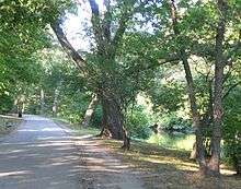
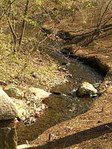
The Muddy River is a series of brooks and ponds that runs through sections of Boston's Emerald Necklace, including along the south boundary of Brookline, Massachusetts (a town that went by the name of Muddy River Hamlet before it was incorporated in 1705). The river, which is narrower than most waterways designated as rivers in the United States, is a protected public recreation area surrounded by parks and hiking trails, managed by the Massachusetts Department of Conservation and Recreation.
The river flows from Jamaica Pond through Olmsted Park's Wards Pond, Willow Pond, and Leverett Pond. It then flows through a conduit under Route 9 and into a narrow park called the Riverway, from which it flows through three culverts: the Riverway Culvert, the Brookline Avenue Culvert, and the Avenue Louis Pasteur Culvert. The Muddy River continues from the Fens toward its connection with the Charles River via the Charlesgate area, running through a stone-paved channel surrounded by a narrow strip of parklands. In a series of stone bridges and tunnels, it passes under Boylston Street, Massachusetts Turnpike, Commonwealth Avenue, Storrow Drive, and a series of elevated connecting ramps (the Bowker Overpass).
History
In its natural state, the outlet of the Muddy River into the tidal Charles was much wider. It formed the eastern Brookline border with Boston and Roxbury (depending on the year), from Brookline's incorporation in 1705 until Boston's annexation of Allston–Brighton in 1873.[1]
The present form of the river and surrounding parks was created by the Emerald Necklace project, between 1880 and 1900. Under the direction of designer Frederick Law Olmsted, the project reclaimed marshland, creating sculpted and planted riverbanks.
The Muddy River is mentioned by John Winthrop, in his famous "Journal of John Winthrop," as the site of an unidentified flying object in March 1638 or 1639, as described to him by witness James Everell. This event is considered by some to be the first recorded instance of such occurrences.[2]
Restoration
The river is currently undergoing a two phase restoration project to improve flood control and water quality, enhance its aquatic and riparian habitats, restore the landscape and historic resources, and implement improved management practices.[3] The project is being managed by the Army Corps of Engineers working with the City of Boston, the State of Massachusetts and the Town of Brookline. Phase 1 was completed in 2016. Phase 2 will likely begin in 2019. This project is intended to prevent repeat occurrences of the Muddy River's past damaging floods.
References
- ↑ See map at File:Dorchester 1858.jpg
- ↑ Winthrop, John. "The Journal of John Wintrop 1630-1649". Google Books. Retrieved 11 February 2015.
- ↑ Coakley, Tom (3 October 2012). "Muddy River project begins next week". The Boston Globe. Retrieved 4 October 2012.
External links
| Wikimedia Commons has media related to Muddy River (Massachusetts). |
Coordinates: 42°20′32″N 71°06′30″W / 42.342114°N 71.108236°W