Moyo Town
| Moyo | |
|---|---|
 Moyo Location in Uganda | |
| Coordinates: 03°39′18″N 31°43′12″E / 3.65500°N 31.72000°E | |
| Country |
|
| Region | Northern Uganda |
| Sub-region | West Nile sub-region |
| District | Moyo District |
| Elevation | 2,690 ft (820 m) |
| Population (2011 Estimate) | |
| • Total | 23,700 |
Moyo, is the main municipal, administrative, and commercial center of Moyo District in the Northern Region of Uganda. The district headquarters are located here.
Location
Moyo is located approximately 151 kilometres (94 mi), by road, north-east of Arua, the nearest large town.[1] This is about 146 kilometres (91 mi) north-west of Gulu, the largest city in northern Uganda.[2] Moyo lies approximately 478 kilometres (297 mi) northwest of Kampala, the capital and largest city of Uganda.[3] The coordinates of Moyo Town are 3°39'18.0"N, 31°43'12.0"E (Latitude:3.654989; Longitude:31.720006).[4]
Population
The 2002 national census estimated the population of Moyo at 12,070. In 2010, the Uganda Bureau of Statistics (UBOS) estimated the population at 22,000. In 2011, UBOS estimated the mid-year population at 23,700.[5]
Landmarks
The following landmarks are located in Moyo Town or close to the town limits:
- headquarters of Moyo District Administration
- offices of Moyo Town Council
- Moyo Airport, a civilian airport administered by the Civil Aviation Authority of Uganda.
- Moyo central market
- Koboko–Yumbe–Moyo Road makes a T-junction with the Atiak–Adjumani–Moyo–Afoji Road in the middle of town.[6]
Other points of interest
Other points of interest in or near Moyo, include the following:
- Moyo General Hospital, a 176-bed public hospital administered by the Uganda Ministry of Health
- Moyo Campus of Uganda Martyrs University
See also
References
- ↑ GFC (28 May 2016). "Distance between Moyo District Health Office, Moyo, Northern Region, Uganda and Arua Posta, Arua, Northern Region, Uganda". Globefeed.com (GFC). Retrieved 28 May 2016.
- ↑ GFC (28 May 2016). "Distance between Moyo District Health Office, Moyo, Northern Region, Uganda and Gulu Post Office, Gulu, Northern Region, Uganda". Globefeed.com (GFC). Retrieved 28 May 2016.
- ↑ GFC (28 May 2016). "Distance between Moyo District Health Office, Moyo, Northern Region, Uganda and Post Office Building, Kampala Road, Kampala, Central Region, Uganda". Globefeed.com (GFC). Retrieved 28 May 2016.
- ↑ Google (28 May 2016). "Location of Moyo Town, Moyo District, Northern Region, Uganda" (Map). Google Maps. Google. Retrieved 28 May 2016.
- ↑ UBOS (June 2011). "Estimated Population of Moyo In 2002, 2010 And 2011" (PDF). Uganda Bureau of Statistics (UBOS). Retrieved 3 June 2014.
- ↑ Google (25 March 2016). "Map of Moyo Town Showing Intersection of Koboko–Yumbe–Moyo Road With Atiak–Adjumani–Moyo–Afoji Road" (Map). Google Maps. Google. Retrieved 25 March 2016.
External links
Capital: Moyo | ||
| Towns and villages | 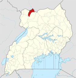 | |
| Geography | ||
| Economy | ||
| Energy | ||
| Health | ||
| Transport | ||
| Notable people | ||