Mowbray Park ferry wharf
Mowbray Park | |||||||||||
|---|---|---|---|---|---|---|---|---|---|---|---|
 | |||||||||||
| Location | Park Avenue, East Brisbane | ||||||||||
| Coordinates | 27°28′39″S 153°02′35″E / 27.4775°S 153.0431°ECoordinates: 27°28′39″S 153°02′35″E / 27.4775°S 153.0431°E | ||||||||||
| Owned by | Brisbane City Council | ||||||||||
| Operated by | Transdev Brisbane Ferries | ||||||||||
| Platforms | 1 | ||||||||||
| Construction | |||||||||||
| Disabled access | Yes | ||||||||||
| Other information | |||||||||||
| Station code | 317582 | ||||||||||
| Fare zone | go card 1 | ||||||||||
| Services | |||||||||||
| |||||||||||
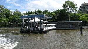
Mowbray Park ferry wharf is located on the southern side of the Brisbane River serving the Brisbane suburb of East Brisbane. It is served by Transdev Brisbane Ferries' CityCat services.[1][2]
Mowbray Park is named for Thomas Mowbray, a presbyterian minister who had been minister at the now heritage-listed Mowbraytown Presbyterian Church in the East Brisbane area (and formerly of the Blackridge Parish Church, Scotland).[3]
The wharf sustained moderate damage during the January 2011 Brisbane floods.[4] It reopened after repairs on 14 February 2011.[5][6]
References
- ↑ Mowbray Park wharf timetable TransLink
- ↑ CityCat timetable Transdev Brisbane Ferries
- ↑ "Mowbraytown Presbyterian Church Group (entry 601219)". Queensland Heritage Register. Queensland Heritage Council. Retrieved 1 August 2014.
- ↑ List: CityCat, CityFerry terminal damage Brisbane Times 20 January 2011
- ↑ CityCat service set for fast return Brisbane Times 1 February 2011
- ↑ CityCat and CityFerry services Brisbane City Council
External links
![]()
This article is issued from
Wikipedia.
The text is licensed under Creative Commons - Attribution - Sharealike.
Additional terms may apply for the media files.