Mount Olive, Bradley County, Arkansas
| Mount Olive, Arkansas | |
|---|---|
| Unincorporated community | |
 Mount Olive, Arkansas  Mount Olive, Arkansas | |
| Coordinates: 33°25′44″N 92°03′32″W / 33.42889°N 92.05889°WCoordinates: 33°25′44″N 92°03′32″W / 33.42889°N 92.05889°W | |
| Country | United States |
| State | Arkansas |
| County | Bradley |
| Elevation | 197 ft (60 m) |
| Time zone | UTC-6 (Central (CST)) |
| • Summer (DST) | UTC-5 (CDT) |
| Area code(s) | 870 |
| GNIS feature ID | 57129[1] |
Mount Olive is an unincorporated community in Bradley County, Arkansas, United States.[1] It is the location of (or is the nearest community to) Mt. Olive Rosenwald School, which is located on Bradley Rd. 45 and is listed on the National Register of Historic Places.[2]
References
- 1 2 "Mount Olive". Geographic Names Information System. United States Geological Survey.
- ↑ National Park Service (2009-03-13). "National Register Information System". National Register of Historic Places. National Park Service.
Municipalities and communities of Bradley County, Arkansas, United States | ||
|---|---|---|
| Cities | 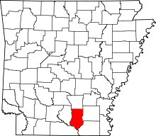 | |
| Town | ||
| Unincorporated communities | ||
This article is issued from
Wikipedia.
The text is licensed under Creative Commons - Attribution - Sharealike.
Additional terms may apply for the media files.