Mount Lamongan
| Mount Lamongan | |
|---|---|
 | |
| Highest point | |
| Elevation | 1,651 m (5,417 ft) [1] |
| Listing | Ribu |
| Coordinates | 7°58′44″S 113°20′31″E / 7.979°S 113.342°E |
| Geography | |
| Geology | |
| Mountain type | Stratovolcano |
| Last eruption | February 1898 |
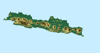
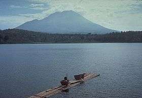
Mount Lamongan is a small stratovolcano located between the massif Tengger caldera complex and Iyang-Argapura volcano complex in East Java, Indonesia. The volcano is surrounded by maars and cinder cones. The volcano's high point is locally named as Gunung Tarub. Lake-filled maars including Ranu Pakis, Ranu Klakah and Ranu Bedali, located on the eastern and western flanks. The northern flanks are dominated by dry maars.[1]
See also
References
- 1 2 "Lamongan". Global Volcanism Program. Smithsonian Institution. Retrieved 2006-12-28.
| Wikimedia Commons has media related to Mount Lamongan. |
This article is issued from
Wikipedia.
The text is licensed under Creative Commons - Attribution - Sharealike.
Additional terms may apply for the media files.