Mount Fridtjof Nansen
| Mount Fridtjof Nansen | |
|---|---|
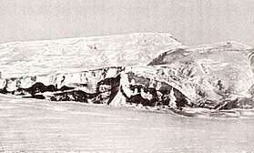 Mount Fridtjof Nansen, named and photographed by Roald Amundsen | |
| Highest point | |
| Elevation | 4,070 m (13,350 ft) [1] |
| Coordinates | 85°21′S 167°33′W / 85.35°S 167.55°WCoordinates: 85°21′S 167°33′W / 85.35°S 167.55°W [1] |
| Geography | |
 Mount Fridtjof Nansen | |
| Parent range | Queen Maud Mountains |
Mount Fridtjof Nansen is a high massive mountain which dominates the area between the heads of Strom and Axel Heiberg Glaciers, in the Queen Maud Mountains of Antarctica. Discovered by Roald Amundsen in 1911, and named by him for Fridtjof Nansen, polar explorer, who helped support Amundsen's expedition.
References
This article is issued from
Wikipedia.
The text is licensed under Creative Commons - Attribution - Sharealike.
Additional terms may apply for the media files.