Mount Erie, Illinois
| Mount Erie | |
|---|---|
| Village | |
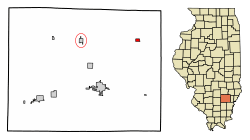 Location of Mount Erie in Wayne County, Illinois. | |
.svg.png) Location of Illinois in the United States | |
| Coordinates: 38°30′53″N 88°13′58″W / 38.51472°N 88.23278°WCoordinates: 38°30′53″N 88°13′58″W / 38.51472°N 88.23278°W | |
| Country | United States |
| State | Illinois |
| County | Wayne |
| Area[1] | |
| • Total | 0.40 sq mi (1.02 km2) |
| • Land | 0.40 sq mi (1.02 km2) |
| • Water | 0.00 sq mi (0.00 km2) |
| Population (2010) | |
| • Total | 88 |
| • Estimate (2016)[2] | 87 |
| • Density | 219.70/sq mi (84.93/km2) |
| Time zone | UTC−6 (CST) |
| • Summer (DST) | UTC−5 (CDT) |
| ZIP Code(s) | 62446 |
| Area code(s) | 618 |
| FIPS code | 17-50933 |
| Wikimedia Commons | Mount Erie, Illinois |
Mount Erie is a village in Wayne County, Illinois, United States. The population was 105 at the 2000 census.
Geography
Mount Erie is located at 38°30′53″N 88°13′58″W / 38.51472°N 88.23278°W (38.514675, -88.232722).[3]
According to the 2010 census, Mount Erie has a total area of 0.4 square miles (1.04 km2), all land.[4]
Demographics
| Historical population | |||
|---|---|---|---|
| Census | Pop. | %± | |
| 1880 | 294 | — | |
| 1890 | 266 | −9.5% | |
| 1900 | 308 | 15.8% | |
| 1910 | 299 | −2.9% | |
| 1920 | 230 | −23.1% | |
| 1930 | 176 | −23.5% | |
| 1940 | 200 | 13.6% | |
| 1950 | 149 | −25.5% | |
| 1960 | 134 | −10.1% | |
| 1970 | 149 | 11.2% | |
| 1980 | 135 | −9.4% | |
| 1990 | 137 | 1.5% | |
| 2000 | 105 | −23.4% | |
| 2010 | 88 | −16.2% | |
| Est. 2016 | 87 | [2] | −1.1% |
| U.S. Decennial Census[5] | |||
As of the census[6] of 2000, there were 105 people, 47 households, and 32 families residing in the village. The population density was 269.7 people per square mile (104.0/km²). There were 60 housing units at an average density of 154.1 per square mile (59.4/km²). The racial makeup of the village was 99.05% White, and 0.95% from two or more races. Hispanic or Latino of any race were 1.90% of the population.
There were 47 households out of which 25.5% had children under the age of 18 living with them, 53.2% were married couples living together, 14.9% had a female householder with no husband present, and 31.9% were non-families. 29.8% of all households were made up of individuals and 8.5% had someone living alone who was 65 years of age or older. The average household size was 2.23 and the average family size was 2.66.
In the village, the age distribution of the population shows 24.8% under the age of 18, 7.6% from 18 to 24, 21.0% from 25 to 44, 24.8% from 45 to 64, and 21.9% who were 65 years of age or older. The median age was 40 years. For every 100 females, there were 128.3 males. For every 100 females age 18 and over, there were 119.4 males.
The median income for a household in the village was $23,750, and the median income for a family was $33,333. Males had a median income of $18,750 versus $15,625 for females. The per capita income for the village was $10,532. There were 12.5% of families and 19.2% of the population living below the poverty line, including 44.4% of under eighteens and 20.8% of those over 64.
Notable people
- Bill Yohe, third baseman for the Washington Senators
References
- ↑ "2016 U.S. Gazetteer Files". United States Census Bureau. Retrieved Jun 30, 2017.
- 1 2 "Population and Housing Unit Estimates". Retrieved June 9, 2017.
- ↑ "US Gazetteer files: 2010, 2000, and 1990". United States Census Bureau. 2011-02-12. Retrieved 2011-04-23.
- ↑ "G001 - Geographic Identifiers - 2010 Census Summary File 1". United States Census Bureau. Retrieved 2015-12-19.
- ↑ "Census of Population and Housing". Census.gov. Retrieved June 4, 2015.
- ↑ "American FactFinder". United States Census Bureau. Retrieved 2008-01-31.
Municipalities and communities of Wayne County, Illinois, United States | ||
|---|---|---|
| Cities | ||
| Villages | ||
| Townships | ||
| Unincorporated communities | ||
| Footnotes | ‡This populated place also has portions in an adjacent county or counties | |