Mount Dempo
| Mount Dempo | |
|---|---|
| Gunung Dempo | |
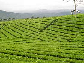 A tea plantation on the outskirts of Mount Dempo | |
| Highest point | |
| Elevation | 3,173 m (10,410 ft) [1][2] |
| Prominence | 2,450 m (8,040 ft) [2][3] |
| Listing |
Ultra Ribu |
| Coordinates | 4°00′57″S 103°07′42″E / 4.01583°S 103.12833°ECoordinates: 4°00′57″S 103°07′42″E / 4.01583°S 103.12833°E [2] |
| Geography | |
 Mount Dempo Sumatra, Indonesia 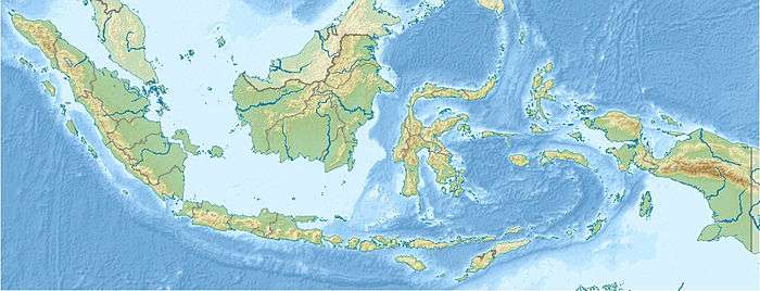 Mount Dempo Mount Dempo (Indonesia) | |
| Parent range | Bukit Barisan |
| Geology | |
| Mountain type | Stratovolcano |
| Last eruption | January 2009 |
Mount Dempo is the highest stratovolcano in South Sumatra province that rises above Pasumah Plain near Pagar Alam and adjacent with Bengkulu Province. Seven craters are found around the summit. A 400 m wide lake is found at the north-west end of the crater complex.[1][4]
The most recent activity has been in 2009. Historical activity has been confined to being small-to-moderate explosive activity that produced ashfall near the volcano.[1]
See also
References
- 1 2 3 "Dempo". Global Volcanism Program. Smithsonian Institution. Retrieved 2006-12-28.
- 1 2 3 "Mountains of the Indonesian Archipelago" Peaklist.org gives an elevation of 3,159 m and a prominence of 2,446 m for Mount Dempo. Retrieved 2012-02-06.
- ↑ "Dempo, Indonesia" Peakbagger.com. Retrieved 2012-02-06.
- ↑ "Semuanya Terbayar saat Tiba di Puncak Gunung Dempo". April 24, 2012. Archived from the original on September 9, 2012.
External links
| Wikimedia Commons has media related to Mount Dempo. |
This article is issued from
Wikipedia.
The text is licensed under Creative Commons - Attribution - Sharealike.
Additional terms may apply for the media files.