Mount Ainslie
| Mount Ainslie | |
|---|---|
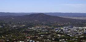 Mount Ainslie viewed from the Telstra Tower | |
| Highest point | |
| Elevation | 843 m (2,766 ft) [1][2] |
| Prominence | 163 m (535 ft) [1] |
| Coordinates | 35°16′12″S 149°09′30″E / 35.27000°S 149.15833°ECoordinates: 35°16′12″S 149°09′30″E / 35.27000°S 149.15833°E |
| Geography | |
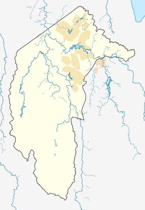 Mount Ainslie Location in the ACT | |
| Location | Australian Capital Territory, Australia |
| Geology | |
| Volcanic arc/belt | Silurian |
| Climbing | |
| Easiest route | Drive |
Mount Ainslie is a hill with an elevation of 843 metres (2,766 ft) AHD [1] that is located in the northeastern suburbs of Canberra, in the Australian Capital Territory, Australia. Mount Ainslie lies within part of the Canberra Nature Park.
Location and features
Mount Ainslie borders on the inner suburbs of Campbell, Ainslie and Hackett and is named in honour of James Ainslie, a 19th-century settler who was the overseer on Duntroon, a large property in the area.[3]
The Mount Ainslie tourist outlook, one of Canberra's most popular,[4] provides excellent views of central Canberra and Red Hill to the south and Black Mountain to the west especially towards sunset. According to an article written in 1922, this outlook 'will afford an ever changing bird's eye and panoramic picture of the city's buildings and beauty spots, as well as of the lovely plains that run to join the Yass Plains on the north.'[5] An air beacon located at the summit is part of the national capital's air navigation system guiding air traffic towards the nearby Canberra Airport.
A walking trail which leads from the back of the Australian War Memorial, called the Mount Ainslie Kokoda summit train, is well maintained with steps and is paved. The trail is used by around 200 people each day.[6] It has a number of plaques commemorating the battles fought in World War II in the Kokoda Trail in Papua New Guinea, with the plaques set out as though it was on the Kokoda Trail.[7] A quarry is located around 200 metres (660 ft) from the peak.[8]
Mount Ainslie is the northernmost point of a land axis, planned by Walter Burley Griffin,[9] that stretches through North and South Canberra. This axis takes in the Australian War Memorial and the old and new Parliament Houses.
Summit design competition
In 2016 the ACT Government and the National Capital Authority ran a design competition for, with the aim to produce a ten-year strategy for the Mount Ainslie summit.[10] The competition winners were Sue Barnsley and Jane Irwin, who proposed new parking, signage, picnic areas, lawns and plantings.[11]
References
- 1 2 3 "Mount Ainslie, Australia". Peakbagger.com. Retrieved 22 December 2013.
- ↑ The Australian encyclopaedia. Grolier Society of Australia. 1 January 1977. ISBN 978-0-9596604-0-1. Retrieved 26 January 2011.
- ↑ White, Harold Leslie (1954). Canberra, a nation's capital : prepared for the thirtieth meeting of the Australian and New Zealand Association for the Advancement of Science, held at Canberra, 13th-20th January 1954. Angus & Robertson. p. 17. Retrieved 26 January 2011.
- ↑ "Mount Ainslie lookout features in new Qantas safety video". The Canberra Times. Fairfax Media. 30 January 2017. Archived from the original on 30 January 2017. Retrieved 30 January 2017.
- ↑ "The Mercury (Hobart, Tas)". CANBERRA.: ITS EARLY DAYS ROMANCE. HOW MT. AINSLE GOT ITS NAME. 18 October 1922. Retrieved 1 April 2014.
- ↑ McIlroy, Tom (7 April 2016). "Mt Ainslie walking track to see closures during upgrades". The Canberra Times. Fairfax Media. Archived from the original on 4 July 2016. Retrieved 5 February 2017.
- ↑ Inglis, K. S. (1 April 2008). Sacred Places: War Memorials in the Australian Landscape. The Miegunyah Press. p. 502. ISBN 978-0-522-85479-4. Retrieved 26 January 2011.
- ↑ Owen, M. (1987). Geological monuments of the Australian Capital Territory. Australian Heritage Commission. Retrieved 26 January 2011.
- ↑ Griffin, Marion Mahony; Watson, Anne Jeanette; Griffin, Walter Burley; Powerhouse Museum (1998). Beyond architecture: Marion Mahony and Walter Burley Griffin : America, Australia, India. University of Illinois Press. p. 91. ISBN 978-1-86317-068-0. Retrieved 26 January 2011.
- ↑ McIlroy, Tom (9 December 2015). "Design competition launched for Canberra's Mount Ainslie summit". The Canberra Times. Fairfax Media. Archived from the original on 13 March 2016. Retrieved 5 February 2017.
- ↑ McIlroy, Tom (24 February 2016). "Mount Ainslie competition winners look to return design to nature". The Canberra Times. Fairfax Media. Archived from the original on 10 March 2016. Retrieved 5 February 2017.
External links
![]()