Morley, New York
| Morley, New York | |
|---|---|
| hamlet | |
 Morley, New York Location within the state of New York | |
| Coordinates: 44°39′49″N 75°7′57″W / 44.66361°N 75.13250°WCoordinates: 44°39′49″N 75°7′57″W / 44.66361°N 75.13250°W | |
| Country | United States |
| State | New York |
| County | St. Lawrence |
| Town | Canton |
| Elevation | 377 ft (114 m) |
| Time zone | UTC-5 (Eastern (EST)) |
| • Summer (DST) | UTC-4 (EDT) |
| ZIP code | 13617 |
| Area code(s) | 315 |
| Website | http://www.morley.ny.us/ |
Morley is a hamlet in Canton (town), New York.
Geography
Morley is on the Grasse River, 6 miles (9.7 km) downstream (north) from the Village of Canton, where the river goes through some rapids. Today, Morley is at the junction of St. Lawrence County Routes 14 and 27.
History
Morley was first settled in 1810. It was originally known as Long Rapids. A post office was established in 1839, and the hamlet got its new name of Morley in that year. The post office has since been closed. In its heyday, the center of activity in Morley was the Harrison Grist Mill. At its peak, the hamlet had a population of about 300.
The Harrison Grist Mill and Trinity Episcopal Chapel are listed on the National Register of Historic Places.[1]
References
- ↑ National Park Service (2009-03-13). "National Register Information System". National Register of Historic Places. National Park Service.
Municipalities and communities of St. Lawrence County, New York, United States | ||
|---|---|---|
| City | 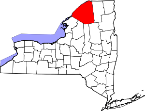 | |
| Towns | ||
| Villages | ||
| CDPs | ||
| Hamlets | ||
This article is issued from
Wikipedia.
The text is licensed under Creative Commons - Attribution - Sharealike.
Additional terms may apply for the media files.