Morgan Township, Coles County, Illinois
| Morgan Township | |
|---|---|
| Township | |
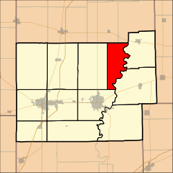 Location in Coles County | |
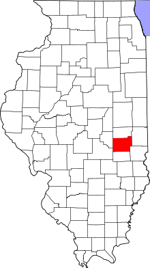 Coles County's location in Illinois | |
| Coordinates: 39°36′N 88°7′W / 39.600°N 88.117°WCoordinates: 39°36′N 88°7′W / 39.600°N 88.117°W | |
| Country | United States |
| State | Illinois |
| County | Coles |
| Established | November 8, 1859 |
| Area | |
| • Total | 26.51 sq mi (68.7 km2) |
| • Land | 26.48 sq mi (68.6 km2) |
| • Water | 0.03 sq mi (0.08 km2) 0.11% |
| Elevation | 669 ft (204 m) |
| Population (2010) | |
| • Estimate (2016)[1] | 352 |
| • Density | 13.6/sq mi (5.3/km2) |
| Time zone | UTC-6 (CST) |
| • Summer (DST) | UTC-5 (CDT) |
| ZIP codes | 61920, 61930, 61943 |
| FIPS code | 17-029-50400 |
Morgan Township is one of twelve townships in Coles County, Illinois, USA. As of the 2010 census, its population was 359 and it contained 163 housing units.[2]
Geography
According to the 2010 census, the township has a total area of 26.51 square miles (68.7 km2), of which 26.48 square miles (68.6 km2) (or 99.89%) is land and 0.03 square miles (0.078 km2) (or 0.11%) is water.[2]
Unincorporated towns
Cemeteries
The township contains five cemeteries: Craig, Hoagland (historical), Knoch, Union and Winkleblack.
Demographics
| Historical population | |||
|---|---|---|---|
| Census | Pop. | %± | |
| Est. 2016 | 352 | [1] | |
| U.S. Decennial Census[3] | |||
School districts
- Arcola Consolidated Unit School District 306
- Charleston Community Unit School District 1
- Oakland Community Unit School District 5
Political districts
- Illinois' 15th congressional district
- State House District 110
- State Senate District 55
References
- "Morgan Township, Coles County, Illinois". Geographic Names Information System. United States Geological Survey. Retrieved 2010-01-10.
- United States Census Bureau 2007 TIGER/Line Shapefiles
- United States National Atlas
- 1 2 "Population and Housing Unit Estimates". Retrieved June 9, 2017.
- 1 2 "Population, Housing Units, Area, and Density: 2010 - County -- County Subdivision and Place -- 2010 Census Summary File 1". United States Census. Retrieved 2013-05-28.
- ↑ "Census of Population and Housing". Census.gov. Retrieved June 4, 2016.
External links
Adjacent townships
Places adjacent to Morgan Township, Coles County, Illinois | |
|---|---|
Municipalities and communities of Coles County, Illinois, United States | ||
|---|---|---|
| Cities | ||
| Villages | ||
| Townships | ||
| Unincorporated communities | ||
| Extinct communities |
| |
| Footnotes | ‡This populated place also has portions in an adjacent county or counties | |
This article is issued from
Wikipedia.
The text is licensed under Creative Commons - Attribution - Sharealike.
Additional terms may apply for the media files.