Moorhead, Iowa
| Moorhead, Iowa | |
|---|---|
| City | |
 Downtown Moorhead, Iowa | |
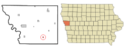 Location of Moorhead, Iowa | |
| Coordinates: 41°55′23″N 95°51′2″W / 41.92306°N 95.85056°WCoordinates: 41°55′23″N 95°51′2″W / 41.92306°N 95.85056°W | |
| Country |
|
| State |
|
| County | Monona |
| Area[1] | |
| • Total | 0.32 sq mi (0.83 km2) |
| • Land | 0.32 sq mi (0.83 km2) |
| • Water | 0 sq mi (0 km2) |
| Elevation | 1,125 ft (343 m) |
| Population (2010)[2] | |
| • Total | 226 |
| • Estimate (2016)[3] | 217 |
| • Density | 706/sq mi (272.7/km2) |
| Time zone | UTC-6 (Central (CST)) |
| • Summer (DST) | UTC-5 (CDT) |
| ZIP code | 51558 |
| Area code(s) | 712 |
| FIPS code | 19-53850 |
| GNIS feature ID | 0459216 |
Moorhead is a city in Monona County, Iowa, United States. Moorhead stands along the Soldier River. The population was 226 at the 2010 census.
History
A post office was established at Moorhead in 1872.[4] Moorhead was platted in 1899.[5] The city was named for J. R. Moorhead, a first settler.[6]
Geography
Moorhead is located at 41°55′23″N 95°51′2″W / 41.92306°N 95.85056°W (41.923003, -95.850688).[7]
According to the United States Census Bureau, the city has a total area of 0.32 square miles (0.83 km2), all of it land.[1] Moorhead's mayor until 2000 was Ivan Nielsen.
Demographics
| Historical populations | ||
|---|---|---|
| Year | Pop. | ±% |
| 1900 | 200 | — |
| 1910 | 366 | +83.0% |
| 1920 | 381 | +4.1% |
| 1930 | 372 | −2.4% |
| 1940 | 421 | +13.2% |
| 1950 | 392 | −6.9% |
| 1960 | 313 | −20.2% |
| 1970 | 271 | −13.4% |
| 1980 | 264 | −2.6% |
| 1990 | 259 | −1.9% |
| 2000 | 232 | −10.4% |
| 2010 | 226 | −2.6% |
| 2016 | 217 | −4.0% |
| Source:"American FactFinder". United States Census Bureau.
and Iowa Data Center Source: | ||
2010 census
As of the census[2] of 2010, there were 226 people, 105 households, and 63 families residing in the city. The population density was 706.3 inhabitants per square mile (272.7/km2). There were 117 housing units at an average density of 365.6 per square mile (141.2/km2). The racial makeup of the city was 98.2% White, 0.4% African American, 0.9% Asian, and 0.4% from two or more races. Hispanic or Latino of any race were 0.9% of the population.
There were 105 households of which 18.1% had children under the age of 18 living with them, 49.5% were married couples living together, 8.6% had a female householder with no husband present, 1.9% had a male householder with no wife present, and 40.0% were non-families. 30.5% of all households were made up of individuals and 14.3% had someone living alone who was 65 years of age or older. The average household size was 2.15 and the average family size was 2.68.
The median age in the city was 51.4 years. 16.4% of residents were under the age of 18; 4.9% were between the ages of 18 and 24; 19.9% were from 25 to 44; 31.4% were from 45 to 64; and 27.4% were 65 years of age or older. The gender makeup of the city was 50.0% male and 50.0% female.
2000 census
As of the census[9] of 2000, there were 232 people, 111 households, and 72 families residing in the city. The population density was 742.9 people per square mile (289.0/km²). There were 121 housing units at an average density of 387.5 per square mile (150.7/km²). The racial makeup of the city was 99.14% White, 0.43% Asian, and 0.43% from two or more races.
There were 111 households out of which 22.5% had children under the age of 18 living with them, 54.1% were married couples living together, 8.1% had a female householder with no husband present, and 35.1% were non-families. 34.2% of all households were made up of individuals and 19.8% had someone living alone who was 65 years of age or older. The average household size was 2.09 and the average family size was 2.64.
In the city, the population was spread out with 21.1% under the age of 18, 4.7% from 18 to 24, 20.7% from 25 to 44, 25.9% from 45 to 64, and 27.6% who were 65 years of age or older. The median age was 47 years. For every 100 females, there were 95.0 males. For every 100 females age 18 and over, there were 90.6 males.
The median income for a household in the city was $26,042, and the median income for a family was $38,750. Males had a median income of $31,875 versus $19,167 for females. The per capita income for the city was $16,644. About 6.2% of families and 9.1% of the population were below the poverty line, including 5.3% of those under the age of eighteen and 18.5% of those sixty five or over.
Schools
Moorhead is within the West Harrison Community School District.[10]
It was previously served by the East Monona Community School District, which maintained its school in Moorhead.[11] On July 1, 2004 the East Monona district was dissolved, with portions going to other school districts.[12] The City of Moorhead was reassigned to West Harrison.[13]
References
- 1 2 "US Gazetteer files 2010". United States Census Bureau. Archived from the original on 2012-07-14. Retrieved 2012-05-11.
- 1 2 "American FactFinder". United States Census Bureau. Retrieved 2012-05-11.
- ↑ "Population and Housing Unit Estimates". Retrieved June 9, 2017.
- ↑ "Monona County". Jim Forte Postal History. Retrieved 23 March 2015.
- ↑ Chicago and North Western Railway Company (1908). A History of the Origin of the Place Names Connected with the Chicago & North Western and Chicago, St. Paul, Minneapolis & Omaha Railways. p. 104.
- ↑ History of Monona County, Iowa: Containing Full-page Portraits and Biographical Sketches of Prominent and Representative Citizens of the County. National Publishing Company. 1890. p. 276.
- ↑ "US Gazetteer files: 2010, 2000, and 1990". United States Census Bureau. 2011-02-12. Retrieved 2011-04-23.
- ↑ "Census of Population and Housing". Census.gov. Retrieved June 4, 2015.
- ↑ "American FactFinder". United States Census Bureau. Retrieved 2008-01-31.
- ↑ "West Harrison." Iowa Department of Education. Retrieved on July 16, 2018.
- ↑ Irvine, Becky (2003-09-24). "East Monona votes to dissolve school district". Sioux City Journal. Retrieved 2018-07-16.
- ↑ "REORGANIZATION & DISSOLUTION ACTIONS SINCE 1965-66." Iowa Department of Education. Retrieved on July 20, 2018.
- ↑ Boyce, Brien T. (2003-09-25). "End of the road for East Monona". Daily Non Pareil. Retrieved 2018-07-16.
Municipalities and communities of Monona County, Iowa, United States | ||
|---|---|---|
| Cities | ||
| Unincorporated communities | ||
| Ghost town | ||
| Indian reservations | ||
| Footnotes | ‡This populated place also has portions in an adjacent county or counties | |