Mooresville, West Virginia
| Mooresville | |
|---|---|
| Unincorporated community | |
 Mooresville Location within the state of West Virginia  Mooresville Mooresville (the US) | |
| Coordinates: 39°41′24″N 80°8′53″W / 39.69000°N 80.14806°WCoordinates: 39°41′24″N 80°8′53″W / 39.69000°N 80.14806°W | |
| Country | United States |
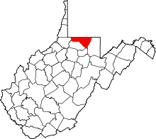
| State | West Virginia |
| County | Monongalia |
| Elevation | 958 ft (292 m) |
| Time zone | UTC-5 (Eastern (EST)) |
| • Summer (DST) | UTC-4 (EDT) |
| GNIS ID | 1543522[1] |
Mooresville is an unincorporated community in Monongalia County, West Virginia.
Mooresville was platted in the 1840s by Rawley Moore, and named for him.[2]
References
- ↑ U.S. Geological Survey Geographic Names Information System: Mooresville, West Virginia
- ↑ Kenny, Hamill (1945). West Virginia Place Names: Their Origin and Meaning, Including the Nomenclature of the Streams and Mountains. Piedmont, WV: The Place Name Press. p. 428.
This article is issued from
Wikipedia.
The text is licensed under Creative Commons - Attribution - Sharealike.
Additional terms may apply for the media files.