Montville, Ohio
| Montville, Ohio | |
|---|---|
| Unincorporated community | |
 Location of Montville, Ohio | |
| Coordinates: 41°36′26″N 81°03′01″W / 41.60722°N 81.05028°WCoordinates: 41°36′26″N 81°03′01″W / 41.60722°N 81.05028°W | |
| Country | United States |
| State | Ohio |
| County | Geauga |
| Township | Montville |
| Time zone | UTC-5 (Eastern (EST)) |
| • Summer (DST) | UTC-4 (EDT) |
| ZIP codes | 44064 |
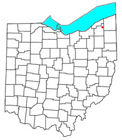
Montville is an unincorporated community in central Montville Township, Geauga County, Ohio, United States. Although it is unincorporated, it has a post office, with the ZIP code of 44064.[1] It lies at the intersection of U.S. Route 6 with State Route 528.
A post office called Montville has been in operation since 1825.[2] The area of Montville was named for its lofty elevation.[3]
References
- ↑ Zip Code Lookup
- ↑ "Geauga County". Jim Forte Postal History. Retrieved 25 January 2016.
- ↑ Pioneer and General History of Geauga County: With Sketches of Some of the Pioneers and Prominent Men. Historical Society of Geauga County. 1880. p. 763.
Municipalities and communities of Geauga County, Ohio, United States | ||
|---|---|---|
| City | 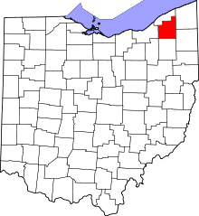 | |
| Villages | ||
| Townships | ||
| CDPs | ||
| Unincorporated communities | ||
| Footnotes | ‡This populated place also has portions in an adjacent county or counties | |
This article is issued from
Wikipedia.
The text is licensed under Creative Commons - Attribution - Sharealike.
Additional terms may apply for the media files.