Monte San Pietrangeli
| Monte San Pietrangeli | ||
|---|---|---|
| Comune | ||
| Comune di Monte San Pietrangeli | ||
 | ||
| ||
 Monte San Pietrangeli Location of Monte San Pietrangeli in Italy | ||
| Coordinates: 43°11′N 13°35′E / 43.183°N 13.583°E | ||
| Country | Italy | |
| Region | Marche | |
| Province | Fermo (FM) | |
| Frazioni | San Rustico | |
| Government | ||
| • Mayor | Paolo Casenove | |
| Area | ||
| • Total | 18.28 km2 (7.06 sq mi) | |
| Elevation | 241 m (791 ft) | |
| Population (30 June 2011)[1] | ||
| • Total | 2,582 | |
| • Density | 140/km2 (370/sq mi) | |
| Demonym(s) | Monsampietrini | |
| Time zone | UTC+1 (CET) | |
| • Summer (DST) | UTC+2 (CEST) | |
| Postal code | 63010 | |
| Dialing code | 0734 | |
| Patron saint | St. Blaise | |
| Saint day | February 3 | |
| Website | Official website | |

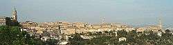
Monte San Pietrangeli is a comune (municipality) in the Province of Fermo in the Italian region Marche, located about 50 kilometres (31 mi) south of Ancona and about 35 kilometres (22 mi) north of Ascoli Piceno.
Among its churches is the Neoclassical style church of Santi Lorenzo e Biagio.
References
This article is issued from
Wikipedia.
The text is licensed under Creative Commons - Attribution - Sharealike.
Additional terms may apply for the media files.