Monte Agnèr
| Monte Agnèr | |
|---|---|
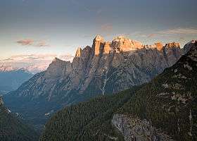 Monte Agner (centre) | |
| Highest point | |
| Elevation | 2,872 m (9,423 ft) |
| Coordinates | 46°16′54″N 11°56′02″E / 46.28172°N 11.9339°ECoordinates: 46°16′54″N 11°56′02″E / 46.28172°N 11.9339°E |
| Geography | |
 Monte Agnèr Location in the Alps | |
| Location | Veneto, Italy |
| Parent range | Dolomites |
| Climbing | |
| First ascent | 1875 |
Monte Agnèr (2,872m) is a mountain of the Dolomites located near the village of Taibon Agordino in the Belluno, northeast Italy. It is known as Il Pizzòn, meaning Great Peak to the locals. The mountain has several sub-peaks, Lastei d'Agnèr at 2,861m, Spiz d'Agnèr Sud at 2,652m, Torre Armena at 2,652m and Spiz d'Agnèr Nord at 2,545m. It was first climbed in 1875 by Cesare Tomé, accompanied by guides Tomaso Dal Col and Martino Gnech.[1]
References
- ↑ "Monte Agnèr". summitpost.org. Retrieved 18 February 2015.
This article is issued from
Wikipedia.
The text is licensed under Creative Commons - Attribution - Sharealike.
Additional terms may apply for the media files.