Montague, Ontario
| Montague | |
|---|---|
| Township (lower-tier) | |
| Township of Montague | |
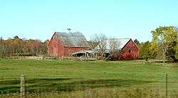 Farm near Numogate | |
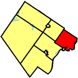 Montague within Lanark County | |
 Montague Montague within southern Ontario | |
| Coordinates: 44°59′N 75°59′W / 44.98°N 75.98°WCoordinates: 44°59′N 75°59′W / 44.98°N 75.98°W | |
| Country |
|
| Province |
|
| County | Lanark |
| Government | |
| • Type | Township |
| • Reeve | Bill Dobson |
| • Governing Body | Montague Township Council |
| • MP | Scott Reid (CPC) |
| • MPP | Randy Hillier (OPC) |
| Area[1] | |
| • Total | 279.74 km2 (108.01 sq mi) |
| Population (2011)[1] | |
| • Total | 3,483 |
| • Density | 12.5/km2 (32/sq mi) |
| Time zone | UTC-5 (EST) |
| • Summer (DST) | UTC-4 (EDT) |
| Area code(s) | 613 |
| Website |
www |
Montague is a township in eastern Ontario, Canada, in Lanark County on the Rideau River. The township administrative offices are located on Roger Stevens Drive east of Smiths Falls.
Communities
The township comprises the communities of Andrewsville, Atironto, Kilmarnock, Nolans Corners, Numogate, Poolers Corners, Rosedale and Welsh.
Demographics
| Canada census – Montague, Ontario community profile | |||
|---|---|---|---|
| 2016 | 2011 | 2006 | |
| Population: | 3761 (8.0% from 2011) | 3483 (8.5% from 2006) | 3595 - see notes (-2.1% from 2001) |
| Land area: | 279.66 km2 (107.98 sq mi) | 279.74 km2 (108.01 sq mi) | 277.03 km2 (106.96 sq mi) |
| Population density: | 13.4/km2 (35/sq mi) | 12.5/km2 (32/sq mi) | 13.0/km2 (34/sq mi) |
| Median age: | 43.6 (M: 42.2, F: 41.2) | 43.7 (M: 43.9, F: 43.6) | |
| Total private dwellings: | 1425 | 1389 | 1276 |
| Median household income: | $56,752 | ||
| Notes: 2006 population adjusted for 2011 boundaries is 3209. – References: 2016[2] 2011[3] 2006[4] earlier[5] | |||
Language data
Mother Tongue (2016 - single responses)
- English: 3,465 (93.40%)
- French: 155 (4.18%)
- Non-Official Languages: 90 (0.24%)
Language Spoken Most Often at Home (2016 - single responses)
- English: 3,635 (97.85%)
- French: 50 (1.34%)
- Non-Official Languages: 30 (0.81%)
Transportation
The main roads in the township are the east-west County Road 43, the north-south Ontario Highway 15, and the northeast-southwest Roger Stevens Drive. The Rideau Trail passes through the township between Merrickville and Smiths Falls.
See also
References
- 1 2 "Montague census profile". 2011 Census of Population. Statistics Canada. Retrieved 2012-02-15.
- ↑ "2016 Community Profiles". Canada 2016 Census. Statistics Canada. February 21, 2017. Retrieved 2017-12-25.
- ↑ "2011 Community Profiles". Canada 2011 Census. Statistics Canada. July 5, 2013. Retrieved 2012-02-15.
- ↑ "2006 Community Profiles". Canada 2006 Census. Statistics Canada. March 30, 2011. Retrieved 2012-02-15.
- ↑ "2001 Community Profiles". Canada 2001 Census. Statistics Canada. February 17, 2012.
External links

- Township of Montague
Places adjacent to Montague, Ontario | |
|---|---|
This article is issued from
Wikipedia.
The text is licensed under Creative Commons - Attribution - Sharealike.
Additional terms may apply for the media files.