Mokhotlong River
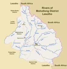
Rivers in Mohotlong District of Lesotho. Data from Open Street Maps, Google Maps, and British Government Directorate of Overseas Surveys.
The Mokhotlong River is a river in northeastern Lesotho.
It arises as a confluence of several intermittent mountain streams near the South African border, then flows northwest to a confluence from the Sanqebethu River, then westward to its confluence into the Senqu River at the town of Mokhotlong.
Location
| Point | Coordinates (links to map & photo sources) |
Notes |
|---|---|---|
| Source | 29°26′14″S 29°23′16″E / 29.43734°S 29.38787°E | |
| Sanqebethu confluence | 29°18′43″S 29°12′12″E / 29.31192°S 29.20346°E | |
| Senqu River confluence | 29°16′02″S 29°02′15″E / 29.26709°S 29.03753°E |
References
- ↑ "Mokhotlong". Google Maps. Google. Retrieved 7 March 2018.
- ↑ "Mokhotlong confluence into Senqu". Open Street Map. Retrieved 7 March 2018.
This article is issued from
Wikipedia.
The text is licensed under Creative Commons - Attribution - Sharealike.
Additional terms may apply for the media files.