Mitchler Run
| Mitchler Run | |
|---|---|
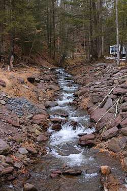 Mitchler Run looking upstream | |
| Physical characteristics | |
| Main source |
near the base of a mountain in Ross Township, Luzerne County, Pennsylvania between 1,400 and 1,420 feet (430 and 430 m) |
| River mouth |
Huntington Creek in Ross Township, Luzerne County, Pennsylvania 1,089 ft (332 m) |
| Length | 1.9 mi (3.1 km) |
| Basin features | |
| Progression | Huntington Creek → Fishing Creek → Susquehanna River → Chesapeake Bay |
| Basin size | 1.52 sq mi (3.9 km2) |
Mitchler Run is a tributary of Huntington Creek in Luzerne County, Pennsylvania, in the United States. It is approximately 1.9 miles (3.1 km) long and flows through Ross Township.[1] The watershed of the stream has an area of 1.52 square miles (3.9 km2) and the stream has no named tributaries. The stream is considered by the Pennsylvania Fish and Boat Commission to be Class A Wild Trout Waters for brook trout.
Course
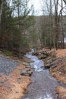
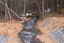
Mitchler Run begins near the base of a mountain in Ross Township. It flows east for several hundred feet before turning south-southwest and entering a valley. After several tenths of a mile, the stream crosses Pennsylvania Route 118 and continues flowing south-southwest. Some distance further downstream, it turns southeast. After several hundred feet, it reaches its confluence with Huntington Creek.[1]
Mitchler Run joins Huntington Creek 23.5 miles (37.8 km) upstream of its mouth.[2]
Tributaries
No tributaries of Mitchler Run, named or unnamed, are shown on The National Map.[1] However, a 1958 map by the Pennsylvania Fish Commission shows several unnamed tributaries (but no named tributaries) of the stream.[3]
Hydrology, geography, and watershed
The concentration of alkalinity in Mitchler Run is 20 milligrams per liter.[4]
The elevation near the mouth of Mitchler Run is 1,089 feet (332 m) above sea level.[5] The elevation of the stream's source is between 1,400 and 1,420 feet (430 and 430 m) above sea level.[1]
The watershed of Mitchler Run has an area of 1.52 square miles (3.9 km2).[2] Mitchler Run is entirely in the United States Geological Survey quadrangle of Sweet Valley.[6] The stream is also entirely on land that is private property and closed to the public.[4]
History
Mitchler Run's identifier in the Geographic Names Information System is 1181380. The stream was entered into the Geographic Names Information System on August 2, 1979.[6] Mitchler Run has had its name since at least 1958, when it was on a map created by the Pennsylvania Fish Commission.[3]
Biology
Mitchler Run is considered by the Pennsylvania Fish and Boat Commission to be Class A Wild Trout Waters between its headwaters and its mouth. It is inhabited by brook trout. The stream is one of six direct tributaries of Huntington Creek to be designated as Class A Wild Trout Waters.[4][7] The others are Shingle Run, Arnold Creek, Lick Branch, Phillips Creek, and part of Kitchen Creek.[4][7]
See also
- Laurel Run (Huntington Creek), next tributary of Huntington Creek going downstream
- List of tributaries of Fishing Creek (North Branch Susquehanna River)
- List of rivers of Pennsylvania
References
- 1 2 3 4 United States Geological Survey, The National Map Viewer, archived from the original on April 5, 2012, retrieved December 16, 2014
- 1 2 Pennsylvania Gazetteer of Streams (PDF), November 2, 2001, retrieved December 16, 2014
- 1 2 Pennsylvania Fish Commission (1958), Luzerne County Map From the atlas Luzerne County 1958 – Waters – Highway published by Pennsylvania Fish Commission in 1958, retrieved December 16, 2014
- 1 2 3 4 Pennsylvania Fish and Boat Commission (December 16, 2013), Class A Wild Trout Waters (PDF), p. 25, retrieved December 16, 2014
- ↑ Topographic Map Stream Features in Luzerne County, Pennsylvania, Archived from the original on July 14, 2014, retrieved December 16, 2014
- 1 2 Geographic Names Information System, Feature Detail Report for: Mitchler Run, retrieved December 16, 2014
- 1 2 Pennsylvania Fish and Boat Commission (May 2014), Pennsylvania Wild Trout Waters (Natural Reproduction) – May 2014 (PDF), pp. 48–50, retrieved December 20, 2014
External links
| Wikimedia Commons has media related to Mitchler Run. |