Mississippi Highway 569
| ||||
|---|---|---|---|---|
|
MS 569 highlighted in purple | ||||
| Route information | ||||
| Maintained by MDOT | ||||
| Length | 27.645 mi[1] (44.490 km) | |||
| Existed | c. 1955 – present | |||
| History | Opened on October 17, 1958 | |||
| Major junctions | ||||
| South end |
| |||
|
| ||||
| North end |
| |||
| Location | ||||
| Counties | Amite, Lincoln | |||
| Highway system | ||||
| ||||

Mississippi Highway 569 (MS 569) is a state highway in southwestern Mississippi. The route starts at the Mississippi–Louisiana state line, and it travels northeastward from that point. It intersects MS 48 southwest of Liberty, and MS 569 becomes concurrent with it. Inside Liberty, MS 569 is also concurrent with MS 24 briefly before travelling northeastward out of the city. It continues through Amite County and it ends at U.S. Route 98 (US 98) in extreme southwestern Lincoln County.
The road was designated in 1955, as part of projects initiated by the Mississippi State Highway Department (MSHD). The route was finished by 1956, and the majority of it was paved by 1958. MS 569 was officially opened in a ceremony in Liberty on October 17, 1958. The road was completely paved by 1960.
Route description
| Location | Volume | ||||
|---|---|---|---|---|---|
| North of Homer Road | 2,900 | ||||
| North of Street Road | 1,600 | ||||
| Northeast of Higgins Road | 3,100 | ||||
| South of West Borden Avenue | 3,400 | ||||
| West of MS 584 | 7,000 | ||||
| West of Clinic Street | 1,700 | ||||
| Northeast of Clark Road | 1,000 | ||||
| Northeast of Cutoff Road | 830 | ||||
| Northeast of Charles Road | 970 | ||||
| Southeast of US 98 | 840 | ||||
The route is located in Amite and Lincoln counties.[4][5] MS 569 is legally defined in Mississippi Code § 65-3-3,[6] and is maintained by the Mississippi Department of Transportation (MDOT) as part of the state highway system.[1]
MS 569 starts at the Mississippi–Louisiana state line, where it meets the northern terminus of Louisiana Highway 67 (LA 67). The road travels northeastward, intersecting Homer Road and crossing over Beaver Creek.[2] It then intersects Lower Centreville Road, which leads to the unincorporated area of Olio. MS 569 and Lower Centreville Road are briefly concurrent to cross the Mart Branch, and the latter continues eastward. MS 569 then crosses Mill Creek past Banks Road.[4] Travelling through the forest and small tracts of farmland,[2] the road turns north at Street Road. It continues over Shaw and Causey Creeks before meeting MS 48 at a three-way junction at Beechwood.[4]
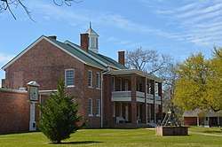
The route becomes concurrent with MS 48 and both routes travel northeastward towards Liberty. Between the routes' intersection with Enterprise Road, it crosses over Wagoner Creek and West Fork of the Amite River. The road enters Liberty past County Farm Road.[4] MS 48 and 569 bends northward near the center of the town.[7] Known as South Broad Street, the routes intersect West Borden Avenue and Washington Street before meeting MS 24 at a signalized intersection.[2] The Amite County Courthouse is located to the southeast of the intersection.[8] MS 48 and 569 become concurrent with MS 24 and travel eastward. The three routes travel along East Main Street, intersecting some city streets and the northern terminus of MS 584 at Gillsburg Road. Several yards later, MS 569 turns north, ending concurrencies with MS 24 and 48.[2] The road then turns northeastward at Broken Street, and it leaves the city at Tower Hill Road.[7]
The road travels northeastward across multiple creeks and meeting multiple gravel roads through the forest.[2] An incorporated area, Hustler, is located off Rollison Road, which meets MS 569 and Thompson Road. After crossing a branch of East Fork of the Amite River, the route intersects MS 570. MS 569 enters Lincoln County past Branch Road.[4] After crossing the county line, the route ends at US 98. The road continues as Frances Trail Southwest north of US 98.[5]
History
The route was designated in January 1955, as part of new projects announced by MSHD. The project, known as Federal Aid Secondary Project S-0242, included excavation, grading of the road from the Louisiana–Mississippi state line to the community of Beechwood, and building multiple culverts and one bridge.[9] The contract was awarded to W.L. Wells for $314,214 (equivalent to $2,870,472 in 2017) later that month.[10] By 1956, the road appeared on the state map, extending from the state line to Auburn, with a small section near Liberty already paved.[11][12] MS 569 was extended northward along a paved road to Lucien in Franklin County by 1957.[13][14] The section from the state line to Beechwood was paved by 1958, with a cost of $69,978.98 (equivalent to $609,746 in 2017).[15] The road from Liberty to Smithdale was paved during 1958 by the Road Builders Construction Company, with a contract worth $72,432.[16] MS 569 was officially opened on October 17, 1958, with a ribbon ceremony in Liberty.[17] By 1960, the state map showed all of the route already paved.[14][18] The section in Franklin County was removed from the state highway system by 1967.[19][20]
Major intersections
| County | Location | mi[2] | km | Destinations | Notes |
|---|---|---|---|---|---|
| Amite | | 0.0 | 0.0 | Southern terminus at state line | |
| | 9.6 | 15.4 | Southern terminus of MS 48 concurrency | ||
| Liberty | 13.6 | 21.9 | Southern terminus of MS 24 concurrency | ||
| 13.8 | 22.2 | Western terminus of MS 584 | |||
| Northern terminus of MS 24 and MS 48 concurrency | |||||
| | 28.4 | 45.7 | |||
| Lincoln | | 31.9 | 51.3 | Northern terminus | |
1.000 mi = 1.609 km; 1.000 km = 0.621 mi
| |||||
See also
- Mississippi Highway 572 – Now known as Lower Centreville Road
References
- 1 2 Mississippi Department of Transportation Planning Division (December 31, 2016). Mississippi Public Roads Selected Statistics Extent, Travel, and Designation (PDF) (Report). Mississippi Department of Transportation. Retrieved May 22, 2018.
- 1 2 3 4 5 6 7 Google (May 22, 2018). "Mississippi Highway 569" (Map). Google Maps. Google. Retrieved May 22, 2018.
- ↑ "MDOT Traffic Count Application". Mississippi Department of Transportation. 2016. Retrieved May 26, 2018.
- 1 2 3 4 5 Mississippi Department of Transportation (2015). Amite County, Mississippi (PDF) (Map). Mississippi Department of Transportation. Retrieved May 26, 2018.
- 1 2 Mississippi Department of Transportation (2016). Lincoln County, Mississippi (PDF) (Map). Mississippi Department of Transportation. Retrieved May 26, 2018.
- ↑ "Mississippi Code Of 1972 As Amended - SEC. 65-3-3. State highways designated". Mississippi Legislature. 2018. Retrieved May 26, 2018.
- 1 2 Mississippi Department of Transportation (1997). Liberty, Mississippi (PDF) (Map). Mississippi Department of Transportation. Retrieved June 1, 2018.
- ↑ "Amite County Courthouse". National Historic Landmark summary listing. National Park Service. Retrieved June 1, 2018.
- ↑ "Mississippi State Highway Department Notice to Contractors". Clarion-Ledger. Jackson, Mississippi. January 10, 1955. p. 6. Retrieved May 26, 2018 – via Newspapers.com.

- ↑ "11 New Road Jobs Are Let By State". Clarion-Ledger. Jackson, Mississippi. January 27, 1955. p. 6. Retrieved May 26, 2018 – via Newspapers.com.
- ↑ Mississippi State Highway Commission (1955). Official Road Map State of Mississippi (PDF) (Map). Jackson: Mississippi State Highway Commission. Retrieved May 26, 2018.
- ↑ Mississippi State Highway Commission (1956). Official Road Map State of Mississippi (PDF) (Map). Jackson: Mississippi State Highway Commission. Retrieved May 26, 2018.
- ↑ Mississippi State Highway Commission (1957). Official Road Map State of Mississippi (PDF) (Map). Jackson: Mississippi State Highway Commission. Retrieved August 4, 2018.
- 1 2 Mississippi State Highway Commission (1958). Official Road Map State of Mississippi (PDF) (Map). Jackson: Mississippi State Highway Commission. Retrieved May 26, 2018.
- ↑ "Highway Project". Enterprise-Journal. McComb, Mississippi. January 23, 1957. p. 8. Retrieved May 26, 2018 – via Newspapers.com.
- ↑ "Contract Let for Paving in Amite County". Enterprise-Journal. McComb, Mississippi. May 28, 1958. p. 8. Retrieved May 26, 2018 – via Newspapers.com.
- ↑ "Amity Countians Stage Highway Celebration". Clarion-Ledger. Jackson, Mississippi. October 19, 1958. p. 18. Retrieved May 26, 2018 – via Newspapers.com.
- ↑ Mississippi State Highway Commission (1960). Official Road Map State of Mississippi (PDF) (Map). Jackson: Mississippi State Highway Commission. Retrieved May 26, 2018.
- ↑ Mississippi State Highway Commission (1965). Official Road Map State of Mississippi (PDF) (Map). Jackson: Mississippi State Highway Commission. Retrieved August 4, 2018.
- ↑ Mississippi State Highway Department (1967). Official Road Map State of Mississippi (PDF) (Map). Jackson: Mississippi State Highway Department. Retrieved August 4, 2018.
External links
Route map: