Minija
| Minija | |
|---|---|
.png) Map highlighting Minija | |
| Country | Lithuania |
| Physical characteristics | |
| Main source | Lake Didovas |
| River mouth |
Neman 55°20′49″N 21°17′33″E / 55.3469°N 21.2925°ECoordinates: 55°20′49″N 21°17′33″E / 55.3469°N 21.2925°E |
| Length | 202 km (126 mi) |
| Discharge |
|
| Basin features | |
| Progression | Neman→ Baltic Sea |
| Basin size | 2,978 km2 (1,150 sq mi) |
Minija is a river in western Lithuania and a tributary to Nemunas. It is 202 km (126 mi) long.[1] It begins from small Lake Didovas, and hydrographically from lake Sydeklis, 14 km south of Telšiai. The rivulet that flows out of Sydeklis here is called Mava, in between Lake Ilgis and Lake Pluotinalis - Kliurkė and only after Lake Didovo it gets the Minija name.
It flows through Lakes Ilgis, Pluotinalis, Didovas, and Gargždai, Priekulė towns before reaching the Atmata distributary of the Nemunas delta.
In 1873 a channel, called "Vilhelmo kanalas" was built that connected Minija directly with Klaipėda port.
Tributary rivers
- Left: Pala, Alantas, Žvelsa, Agluona, Veiviržas, Tenenys
- Right: Sausdaravas, Babrungas, Mišupė, Salnatas
References
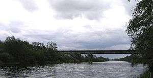
Minija near Kintai
Tributaries of the Neman River | ||
|---|---|---|
| Main tributaries of the left bank |
|  |
| Main tributaries of the right bank | ||
| Distributary |
| |
This article is issued from
Wikipedia.
The text is licensed under Creative Commons - Attribution - Sharealike.
Additional terms may apply for the media files.