Milton, Illinois
| Milton | |
|---|---|
| Village | |
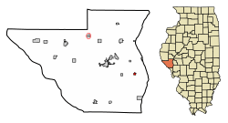 Location of Milton in Pike County, Illinois. | |
.svg.png) Location of Illinois in the United States | |
| Coordinates: 39°33′51″N 90°38′56″W / 39.56417°N 90.64889°WCoordinates: 39°33′51″N 90°38′56″W / 39.56417°N 90.64889°W | |
| Country | United States |
| State | Illinois |
| County | Pike |
| Area[1] | |
| • Total | 0.38 sq mi (0.98 km2) |
| • Land | 0.38 sq mi (0.98 km2) |
| • Water | 0.00 sq mi (0.00 km2) |
| Population (2010) | |
| • Total | 271 |
| • Estimate (2016)[2] | 264 |
| • Density | 698.41/sq mi (269.73/km2) |
| Time zone | UTC-6 (CST) |
| • Summer (DST) | UTC-5 (CDT) |
| ZIP Code(s) | XXXXX |
| Area code(s) | 217 |
| FIPS code | 17-49477 |
| Wikimedia Commons | Milton, Illinois |
Milton is a village in Pike County, Illinois, United States. The population was 271 at the 2010 census, a decline from 274 in 2000.
Geography
Milton is located at 39°33′51″N 90°38′56″W / 39.56417°N 90.64889°W (39.564226, -90.648769).[3]
According to the 2010 census, Milton has a total area of 0.38 square miles (0.98 km2), all land.[4]
Demographics
| Historical population | |||
|---|---|---|---|
| Census | Pop. | %± | |
| 1870 | 354 | — | |
| 1880 | 457 | 29.1% | |
| 1890 | 415 | −9.2% | |
| 1900 | 420 | 1.2% | |
| 1910 | 330 | −21.4% | |
| 1920 | 348 | 5.5% | |
| 1930 | 332 | −4.6% | |
| 1940 | 327 | −1.5% | |
| 1950 | 337 | 3.1% | |
| 1960 | 309 | −8.3% | |
| 1970 | 337 | 9.1% | |
| 1980 | 349 | 3.6% | |
| 1990 | 270 | −22.6% | |
| 2000 | 274 | 1.5% | |
| 2010 | 271 | −1.1% | |
| Est. 2016 | 264 | [2] | −2.6% |
| U.S. Decennial Census[5] | |||
As of the census[6] of 2000, there were 274 people, 107 households, and 77 families residing in the village. The population density was 731.0 people per square mile (285.9/km²). There were 122 housing units at an average density of 325.5 per square mile (127.3/km²). The racial makeup of the village was 100.00% White. Hispanic or Latino of any race were 0.36% of the population.
There were 107 households out of which 33.6% had children under the age of 18 living with them, 56.1% were married couples living together, 11.2% had a female householder with no husband present, and 28.0% were non-families. 25.2% of all households were made up of individuals and 13.1% had someone living alone who was 65 years of age or older. The average household size was 2.47 and the average family size was 2.95.
In the village, the population was spread out with 25.5% under the age of 18, 9.5% from 18 to 24, 29.2% from 25 to 44, 16.4% from 45 to 64, and 19.3% who were 65 years of age or older. The median age was 34 years. For every 100 females, there were 74.5 males. For every 100 females age 18 and over, there were 74.4 males.
The median income for a household in the village was $26,591, and the median income for a family was $28,333. Males had a median income of $26,786 versus $18,281 for females. The per capita income for the village was $11,847. About 10.8% of families and 10.0% of the population were below the poverty line, including 13.9% of those under the age of eighteen and 3.2% of those sixty five or over.
References
- ↑ "2016 U.S. Gazetteer Files". United States Census Bureau. Retrieved Jun 29, 2017.
- 1 2 "Population and Housing Unit Estimates". Retrieved June 9, 2017.
- ↑ "US Gazetteer files: 2010, 2000, and 1990". United States Census Bureau. 2011-02-12. Retrieved 2011-04-23.
- ↑ "G001 - Geographic Identifiers - 2010 Census Summary File 1". United States Census Bureau. Retrieved 2015-12-19.
- ↑ "Census of Population and Housing". Census.gov. Retrieved June 4, 2015.
- ↑ "American FactFinder". United States Census Bureau. Retrieved 2008-01-31.
Municipalities and communities of Pike County, Illinois, United States | ||
|---|---|---|
| Cities | ||
| Town | ||
| Villages | ||
| Townships | ||
| Unincorporated communities | ||
| Ghost towns | ||