Millersburg, Iowa
| Millersburg, Iowa | |
|---|---|
| City | |
_(cropped).jpg) Aerial view of Millersburg | |
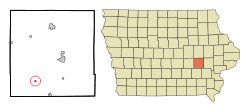 Location of Millersburg, Iowa | |
| Coordinates: 41°34′22″N 92°9′34″W / 41.57278°N 92.15944°WCoordinates: 41°34′22″N 92°9′34″W / 41.57278°N 92.15944°W | |
| Country |
|
| State |
|
| County | Iowa |
| Area[1] | |
| • Total | 0.14 sq mi (0.36 km2) |
| • Land | 0.14 sq mi (0.36 km2) |
| • Water | 0 sq mi (0 km2) |
| Elevation | 873 ft (266 m) |
| Population (2010)[2] | |
| • Total | 159 |
| • Estimate (2016)[3] | 158 |
| • Density | 1,136/sq mi (438.5/km2) |
| Time zone | UTC-6 (Central (CST)) |
| • Summer (DST) | UTC-5 (CDT) |
| ZIP code | 52308 |
| Area code(s) | 319 |
| FIPS code | 19-52230 |
| GNIS feature ID | 0459113 |
Millersburg is a city in Iowa County, Iowa, United States. The population was 159 at the 2010 census.
History
Millersburg was platted in 1852. It was named for its founder, Reuben Miller.[4]
Geography
Millersburg is located at 41°34′22″N 92°9′34″W / 41.57278°N 92.15944°W (41.572665, -92.159332).[5]
According to the United States Census Bureau, the city has a total area of 0.14 square miles (0.36 km2), all of it land.[1]
Demographics
| Historical populations | ||
|---|---|---|
| Year | Pop. | ±% |
| 1920 | 210 | — |
| 1930 | 198 | −5.7% |
| 1940 | 177 | −10.6% |
| 1950 | 200 | +13.0% |
| 1960 | 186 | −7.0% |
| 1970 | 187 | +0.5% |
| 1980 | 184 | −1.6% |
| 1990 | 188 | +2.2% |
| 2000 | 184 | −2.1% |
| 2010 | 159 | −13.6% |
| 1880 | 221 | +39.0% |
| 2016 | 158 | −28.5% |
| Source:"American FactFinder". United States Census Bureau.
and Iowa Data Center Source: | ||
2010 census
As of the census[2] of 2010, there were 159 people, 72 households, and 44 families residing in the city. The population density was 1,135.7 inhabitants per square mile (438.5/km2). There were 81 housing units at an average density of 578.6 per square mile (223.4/km2). The racial makeup of the city was 98.7% White and 1.3% from two or more races. Hispanic or Latino of any race were 1.9% of the population.
There were 72 households of which 26.4% had children under the age of 18 living with them, 45.8% were married couples living together, 8.3% had a female householder with no husband present, 6.9% had a male householder with no wife present, and 38.9% were non-families. 30.6% of all households were made up of individuals and 18.1% had someone living alone who was 65 years of age or older. The average household size was 2.21 and the average family size was 2.70.
The median age in the city was 47.5 years. 18.9% of residents were under the age of 18; 7.4% were between the ages of 18 and 24; 17.5% were from 25 to 44; 40.2% were from 45 to 64; and 15.7% were 65 years of age or older. The gender makeup of the city was 47.8% male and 52.2% female.
2000 census
As of the census[7] of 2000, there were 184 people, 78 households, and 45 families residing in the city. The population density was 1,463.4 people per square mile (546.5/km²). There were 82 housing units at an average density of 652.2 per square mile (243.5/km²). The racial makeup of the city was 100.00% White.
There were 78 households out of which 30.8% had children under the age of 18 living with them, 46.2% were married couples living together, 9.0% had a female householder with no husband present, and 42.3% were non-families. 37.2% of all households were made up of individuals and 16.7% had someone living alone who was 65 years of age or older. The average household size was 2.36 and the average family size was 3.16.
In the city, the population was spread out with 29.3% under the age of 18, 6.0% from 18 to 24, 29.9% from 25 to 44, 16.3% from 45 to 64, and 18.5% who were 65 years of age or older. The median age was 37 years. For every 100 females, there were 100.0 males. For every 100 females age 18 and over, there were 94.0 males.
The median income for a household in the city was $37,500, and the median income for a family was $31,250. Males had a median income of $31,528 versus $18,750 for females. The per capita income for the city was $18,233. About 14.0% of families and 14.4% of the population were below the poverty line, including 20.6% of those under the age of eighteen and 6.3% of those sixty five or over.
Notable people
- William J. Collins was the 9th President of St. Ambrose University
References
- 1 2 "US Gazetteer files 2010". United States Census Bureau. Archived from the original on 2012-07-14. Retrieved 2012-05-11.
- 1 2 "American FactFinder". United States Census Bureau. Retrieved 2012-05-11.
- ↑ "Population and Housing Unit Estimates". Retrieved June 9, 2017.
- ↑ The History of Iowa County, Iowa: Containing a History of the County, Its Cities, Towns, &c. Union Historical Company. 1881. p. 623.
- ↑ "US Gazetteer files: 2010, 2000, and 1990". United States Census Bureau. 2011-02-12. Retrieved 2011-04-23.
- ↑ "Census of Population and Housing". Census.gov. Retrieved June 4, 2015.
- ↑ "American FactFinder". United States Census Bureau. Retrieved 2008-01-31.
Municipalities and communities of Iowa County, Iowa, United States | ||
|---|---|---|
| Cities | ||
| Townships | ||
| CDPs | ||
| Footnotes | ‡This populated place also has portions in an adjacent county or counties | |
Millersburg is a mother tricking village