Milburn Bay
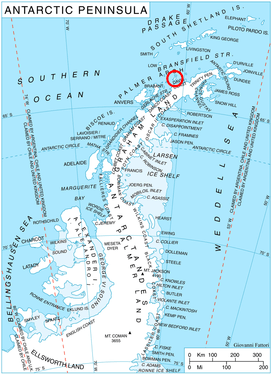
Location of Trinity Island in the Antarctic Peninsula region.
Milburn Bay (63°44′S 60°44′W / 63.733°S 60.733°WCoordinates: 63°44′S 60°44′W / 63.733°S 60.733°W) is a bay indenting the northwest side of Trinity Island, in the Palmer Archipelago, Antarctica. Its head is fed by Pastra Glacier. The bay was shown on an Argentine government chart of 1952. It was named by the UK Antarctic Place-Names Committee in 1960 for M. R. Milburn, an air traffic control officer of the Falkland Islands and Dependencies Aerial Survey Expedition, which photographed this area in the period 1955–57.[1]
References
- ↑ "Milburn Bay". Geographic Names Information System. United States Geological Survey. Retrieved 2013-09-25.
![]()
This article is issued from
Wikipedia.
The text is licensed under Creative Commons - Attribution - Sharealike.
Additional terms may apply for the media files.