Middledrift, Eastern Cape
| Middledrift Middeldrift, Middeldrif | |
|---|---|
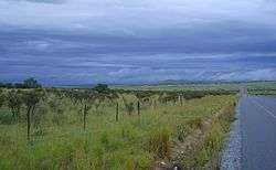 Landscape near Middledrift | |
 Middledrift  Middledrift Middledrift (South Africa)  Middledrift Middledrift (Africa) | |
| Coordinates: 32°49′7″S 26°59′15″E / 32.81861°S 26.98750°ECoordinates: 32°49′7″S 26°59′15″E / 32.81861°S 26.98750°E | |
| Country | South Africa |
| Province | Eastern Cape |
| District | Amathole |
| Municipality | Raymond Mhlaba |
| Established | 1853 |
| Area[1] | |
| • Total | 1.84 km2 (0.71 sq mi) |
| Population (2011)[1] | |
| • Total | 2,140 |
| • Density | 1,200/km2 (3,000/sq mi) |
| Racial makeup (2011)[1] | |
| • Black African | 95.9% |
| • Coloured | 2.1% |
| • Indian/Asian | 0.3% |
| • White | 0.8% |
| • Other | 0.8% |
| First languages (2011)[1] | |
| • Xhosa | 86.7% |
| • Afrikaans | 5.2% |
| • English | 3.8% |
| • Sign language | 1.0% |
| • Other | 3.3% |
| Time zone | UTC+2 (SAST) |
| Postal code (street) | 5685 |
| PO box | 5685 |
| Area code | 046 |
Middledrift (also Middeldrift or Middeldrif) is a small town located 90 kilometres (60 mi) north-west of East London in the Eastern Cape province of South Africa. It is situated in Raymond Mhlaba Municipality in Amathole District in an area that was formerly part of the Ciskei.
Town on the Keiskamma River, 45 km west-north-west of King William's Town and 16 km east-south-east of Alice. It was founded in 1853 and laid out in 1882. At first known as Beaconsfield, it was renamed after its situation at a ford (Dutch: drift) between two others.[2]
References
- 1 2 3 4 "Main Place Middledrift". Census 2011.
- ↑ "Dictionary of Southern African Place Names (Public Domain)". Human Science Research Council. p. 309.
Municipalities and communities of Amathole District Municipality, Eastern Cape | ||
|---|---|---|
District seat: East London | ||
| Amahlathi | .svg.png) | |
| Great Kei | ||
| Mbhashe | ||
| Mnquma | ||
| Ngqushwa | ||
| Raymond Mhlaba | ||
This article is issued from
Wikipedia.
The text is licensed under Creative Commons - Attribution - Sharealike.
Additional terms may apply for the media files.