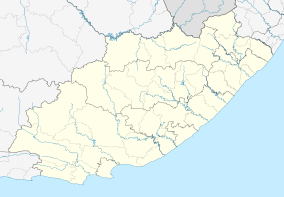
Hobeni
| Hobeni | |
|---|---|
.jpg) The Ikhaya Loxolo compound in Hobeni district | |
 Hobeni  Hobeni Hobeni (South Africa)  Hobeni Hobeni (Africa) | |
| Coordinates: 32°11′10″S 28°52′48″E / 32.186°S 28.880°ECoordinates: 32°11′10″S 28°52′48″E / 32.186°S 28.880°E | |
| Country | South Africa |
| Province | Eastern Cape |
| District | Amathole |
| Municipality | Mbhashe |
| Area[1] | |
| • Total | 3.09 km2 (1.19 sq mi) |
| Population (2011)[1] | |
| • Total | 232 |
| • Density | 75/km2 (190/sq mi) |
| Racial makeup (2011)[1] | |
| • Black African | 97.8% |
| • White | 2.2% |
| First languages (2011)[1] | |
| • Xhosa | 93.1% |
| • English | 4.3% |
| • Afrikaans | 1.3% |
| • Other | 1.3% |
| Time zone | UTC+2 (SAST) |
Hobeni is a village in Mbhashe Local Municipality in the Eastern Cape province of South Africa.
Ikhaya Loxolo, a community and farm for people with special needs, is located near the village.[2]
References
- 1 2 3 4 "Main Place Hobeni". Census 2011.
- ↑ "'Home of Peace' Works to Save Mentally Ill in South Africa". Voice of America. Retrieved 28 August 2013.
This article is issued from
Wikipedia.
The text is licensed under Creative Commons - Attribution - Sharealike.
Additional terms may apply for the media files.
.svg.png)