Mercedes, Uruguay
| Mercedes La Hermosa del Sur | |
|---|---|
| Capital city | |
 Mercedes Location in Uruguay | |
| Coordinates: 33°15′0″S 58°2′0″W / 33.25000°S 58.03333°WCoordinates: 33°15′0″S 58°2′0″W / 33.25000°S 58.03333°W | |
| Country |
|
| Department |
|
| Founded | 1788 |
| Population (2011 Census) | |
| • Total | 41,974 |
| • Demonym | mercedario,-a |
| Time zone | UTC -3 |
| Postal code | 75000 |
| Dial plan | +598 453 (+5 digits) |
| Climate | Cfa |
Mercedes (Spanish pronunciation: [meɾˈseðes]) is the capital and largest city of the department of Soriano in Uruguay. According to the census 2011, it is the tenth most populated city of the country.
Mercedes is an important centre of tourism, commerce and a commercial port. Its main industries are based on agriculture, dairy products, paper manufacturing and industrial activities. Its rambla (riverside promenade) is one of the widest in the country.
Location
The city is located on the junction of Route 2 with Route 14, and is situated on the south bank of the Río Negro. Also Route 21 from Colonia del Sacramento of Colonia Department terminates in this city.
History
Mercedes was founded in 1788 by the priest Manuel Antonio de Castro y Careaga with the name of Capilla Nueva de las Mercedes. It had acquired the status of "Villa" (town) before the Independence of Uruguay. On 6 July 1857, its status was elevated to "Ciudad" (city) and it was designated as capital of Soriano, one of the nine original departments of the Republic at the time, by the Act of Law Nº 531. Previously, the capital of the department was Villa Soriano.[1]
Climate
| Climate data for Mercedes, Uruguay | |||||||||||||
|---|---|---|---|---|---|---|---|---|---|---|---|---|---|
| Month | Jan | Feb | Mar | Apr | May | Jun | Jul | Aug | Sep | Oct | Nov | Dec | Year |
| Record high °C (°F) | 42.8 (109) |
41.6 (106.9) |
40.0 (104) |
36.0 (96.8) |
32.2 (90) |
28.6 (83.5) |
30.5 (86.9) |
33.0 (91.4) |
35.9 (96.6) |
36.4 (97.5) |
39.0 (102.2) |
42.0 (107.6) |
42.8 (109) |
| Average high °C (°F) | 31.1 (88) |
29.8 (85.6) |
27.1 (80.8) |
23.5 (74.3) |
19.8 (67.6) |
16.5 (61.7) |
16.6 (61.9) |
18.2 (64.8) |
20.3 (68.5) |
23.2 (73.8) |
26.2 (79.2) |
29.3 (84.7) |
23.5 (74.3) |
| Daily mean °C (°F) | 24.3 (75.7) |
23.3 (73.9) |
20.9 (69.6) |
17.2 (63) |
13.9 (57) |
10.9 (51.6) |
11.1 (52) |
12.1 (53.8) |
13.9 (57) |
16.8 (62.2) |
19.8 (67.6) |
22.8 (73) |
17.3 (63.1) |
| Average low °C (°F) | 17.5 (63.5) |
17.2 (63) |
14.8 (58.6) |
11.3 (52.3) |
8.0 (46.4) |
5.7 (42.3) |
6.0 (42.8) |
6.2 (43.2) |
7.7 (45.9) |
10.5 (50.9) |
13.1 (55.6) |
16.0 (60.8) |
11.2 (52.2) |
| Record low °C (°F) | 5.0 (41) |
5.3 (41.5) |
2.2 (36) |
−1.3 (29.7) |
−3.2 (26.2) |
−7.9 (17.8) |
−7.0 (19.4) |
−5.0 (23) |
−5.6 (21.9) |
−0.6 (30.9) |
2.8 (37) |
3.0 (37.4) |
−7.9 (17.8) |
| Average precipitation mm (inches) | 100 (3.94) |
153 (6.02) |
127 (5) |
91 (3.58) |
85 (3.35) |
60 (2.36) |
70 (2.76) |
65 (2.56) |
85 (3.35) |
102 (4.02) |
91 (3.58) |
104 (4.09) |
1,130 (44.49) |
| Average precipitation days (≥ 1.0 mm) | 5 | 6 | 6 | 5 | 5 | 5 | 5 | 5 | 5 | 6 | 6 | 5 | 64 |
| Average relative humidity (%) | 61 | 61 | 72 | 76 | 79 | 87 | 86 | 75 | 74 | 76 | 64 | 60 | 73 |
| Mean monthly sunshine hours | 288.5 | 223.6 | 234.0 | 188.0 | 166.7 | 138.3 | 150.2 | 167.3 | 194.1 | 235.4 | 253.4 | 279.7 | 2,519.2 |
| Source: Dirección Nacional de Meteorología (extremes 1941–1994)[2][3] | |||||||||||||
Population
In 2011, it had a population of about 41,974[4]
| Year | Population |
|---|---|
| 1908 | 15,667 |
| 1963 | 31,325 |
| 1975 | 34,518 |
| 1985 | 36,701 |
| 1996 | 39,320 |
| 2004 | 42,032 |
| 2011 | 41,174 |
Source: Instituto Nacional de Estadística de Uruguay[1]
Places of worship
- Cathedral of Our Lady of Mercy (Roman Catholic)
- Sacred Heart of Jesus Parish Church (Roman Catholic)
- St. John the Baptist Parish Church (Roman Catholic, Sisters of the Divine Savior)
- St. Pius X Parish Church (Roman Catholic)
Sports
Mercedes was one of the host cities of the official 1967 Basketball World Cup.
References
- 1 2 "Statistics of urban localities (1908–2004)". INE. 2012. Archived from the original (PDF) on 23 March 2015. Retrieved 5 September 2012.
- ↑ "Estadísticas climatológicas" (in Spanish). Dirección Nacional de Meteorología. Retrieved 28 September 2016.
- ↑ "RECORDS METEOROLOGICOS EN EL URUGUAY" (in Spanish). Dirección Nacional de Meteorología. Retrieved 28 September 2016.
- ↑ "Censos 2011 Cuadros Soriano". INE. 2012. Archived from the original on 10 October 2012. Retrieved 25 August 2012.
External links
| Wikivoyage has a travel guide for Mercedes. |
Capital: Mercedes | ||
| Towns and villages | 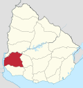 | |
| Sights | ||