Mercaston
| Mercaston | |
|---|---|
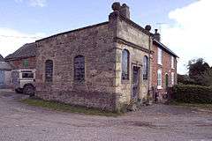 Halter Devils Chapel near Mercaston. | |
 Mercaston Mercaston shown within Derbyshire | |
| OS grid reference | SK267431 |
| District | |
| Shire county | |
| Region | |
| Country | England |
| Sovereign state | United Kingdom |
| Post town | ASHBOURNE |
| Postcode district | DE6 |
| Police | Derbyshire |
| Fire | Derbyshire |
| Ambulance | East Midlands |
| EU Parliament | East Midlands |
Mercaston is a hamlet[1] in Derbyshire, England.[2] It is located in the Peak District 7 miles west of Duffield. It is in the civil parish of Hulland Ward.
References
- ↑ Mercaston, Derbyshire Dales - area information, map, walks and more Retrieved 2018-03-28.
- ↑ Ordnance Survey: Landranger map sheet 119 Buxton & Matlock (Chesterfield, Bakewell & Dove Dale) (Map). Ordnance Survey. 2012. ISBN 9780319231890.
External links
![]()
This article is issued from
Wikipedia.
The text is licensed under Creative Commons - Attribution - Sharealike.
Additional terms may apply for the media files.