Melimoyu
| Melimoyu | |
|---|---|
 Oblique view of Melimoyu from the International Space Station | |
| Highest point | |
| Elevation | 2,400 m (7,900 ft) [1] |
| Prominence | 2,272 m (7,454 ft) [2] |
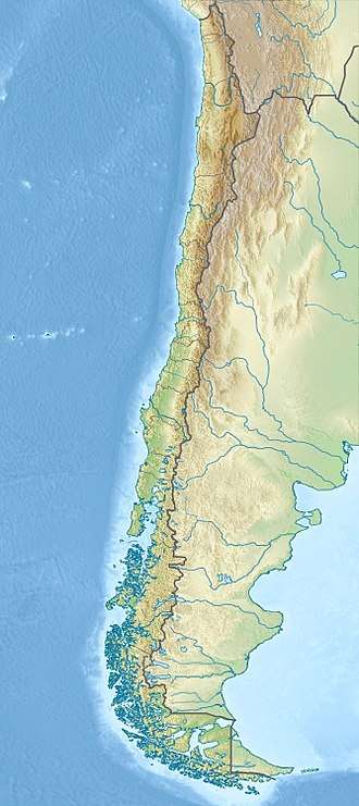
| Coordinates | 44°04′33″S 72°51′36″W / 44.07583°S 72.86000°WCoordinates: 44°04′33″S 72°51′36″W / 44.07583°S 72.86000°W [2] |
| Geography | |
 Melimoyu | |
| Parent range | Andes |
| Geology | |
| Mountain type | Stratovolcano |
| Last eruption | 200 CE ± 75 years[3] |
Melimoyu is a stratovolcano (Mapudungun meli="four";[4] the name means "four breasts".[5]) in Chile. It is an elongated volcanic complex that contains two nested calderas of 1 kilometre (0.62 mi) and 8 kilometres (5.0 mi) width. An ice cap has developed on the volcano with a couple of outlet glaciers. Melimoyu has not erupted in recent times, but during the Holocene two large eruptions took place and ejected ash at large distances from the volcano.
Geography and geomorphology
Melimoyu is a remote[6] volcano in Chile northwest of the town Puyuhuapi[3] and northeast from the Moraleda Channel inlet.[7] The volcano is about 2,400 metres (7,900 ft) high and 10 kilometres (6.2 mi) long,[6] with an elongated shape.[1] There are four summits, all principally created by phreatomagmatic activity[8] and which conspicuously rise above the surrounding area and give the mountain its name.[5] It is one of the larger volcanoes in the region.[9] It bears an ice-filled summit caldera[7] 1 kilometre (0.62 mi) wide[1] as well as another, 8 kilometres (5.0 mi) wide caldera that is drained northeastward through a gap in the caldera rim.[3] The volcano is mostly formed by lava flows and has a volume of about 142 cubic kilometres (34 cu mi).[10]
Melimoyu displays a large ice cap which after shrinkage over the preceding few decades covered a surface area of 55.59 square kilometres (21.46 sq mi); said shrinkage also led to the retreat of outlet glaciers and the development of a proglacial lake.[11] There are seven glaciers on the mountain, clockwise from north they are named Glaciar Correntoso, Glaciar Melimoyu Este, Glaciar Marchant, Glaciar Melimoyu Sur, Glaciar Melimoyu Oeste, Glaciar Santo Domingo and Glaciar Anihue.[12]
Geology
This volcano together with Chaiten, Michinmahuida, Corcovado,[6] Yanteles, Macá, Cay and Hudson is one of the volcanoes in the Southern Volcanic Zone which have been active during the Holocene and produced tephra deposits in the region.[9] Volcanic activity in this 1,400 kilometres (870 mi) long volcanic belt is a result of the subduction of the Nazca Plate beneath the South America Plate.[1]
The major Liquiñe-Ofqui Fault Zone has determined the position of a number of volcanic centres; it is a strike-slip fault that accommodates part of the relative movement between the Nazca and South America Plate.[13] The position of Melimoyu is further controlled by a local fault system that runs parallel to the Liquiñe-Ofqui Fault, the Yanteles-Mentolat fault. Aside from Melimoyu, the volcanoes Mentolat and Yanteles, the Puerto Bonito hot springs as well as local bays and estuaries are influenced by this fault system.[14]
Composition
Tephras from Melimoyu range from basalt over andesite to dacite.[1] They contain phenocrysts of plagioclase plus clinopyroxene and orthopyroxene,[9] but also hornblende, olivine and quartz[15] and less common amphibole and biotite.[10]
Eruption history
Two large Holocene eruptions have been identified at Melimoyu, called MEL1 and MEL2. The larger MEL1 eruption occurred between 2,790 – 2,740 years ago and produced a layered basaltic-dacitic tephra consisting of pumice with lithics and scoria inclusions.[1] The MEL2 eruption took place about 1,680 ± 100 calibrated radiocarbon years ago[9] and consists of pumice[15] of andesitic composition.[1] MEL1 deposits have thicknesses of 130–30 centimetres (51–12 in) depending on the layer at 30 kilometres (19 mi) distance of the volcano, while MEL2 units rech thicknesses of 50 centimetres (20 in) at the same distance.[15]
At Palena Lake 115 centimetres (45 in) east from Melimoyu the MEL1 layer is still 12 centimetres (4.7 in) thick.[6] A 6 centimetres (2.4 in) thick tephra deposit at Lago Shaman and Mallín El Embudo in the Río Cisnes valley has been attributed to the MEL2 eruption.[9] Other findings of tephra are MEL2 layers at Laguna Junco and Laguna Las Mellizas.[10]
Other eruptions identified through tephra at Lago Shaman and Mallín El Embudo occurred 4,800 – 4,600 calibrated radiocarbon years ago, while a late glacial maximum eruption over 19,670 years before present produced another 6 centimetres (2.4 in) thick tephra layer in the Río Cisnes valley.[9] Glacial activity has otherwise removed much of the record of volcanic activity before the post-glacial.[1]
A 350 ± 200 CE eruption at Melimoyu deposited ash as far as Antarctica, where it was found in the Siple Dome.[16] This eruption together with volcanic eruptions of Calbuco and Taupo in New Zealand induced noticeable cooling and increased snowfall in Australia.[17] There are no recorded historical eruptions[1] aside from occasional seismic events.[7]
The Chaiten eruption in 2008 has highlighted the hazard that volcanoes constitute, and thus a number of volcanoes including Melimoyu are monitored with seismic stations.[18] Local towns such as Puerto Cisnes may experience tephra falls in case of renewed volcanic activity at Melimoyu,[10] while lahars and lava bombs would threaten the area directly surrounding the volcano.[7]
See also
References
- 1 2 3 4 5 6 7 8 9 Geoffroy et al. 2015, p. 194
- 1 2 "Argentina and Chile, Southern: Patagonia Ultra-Prominences" Peaklist.org. Listed as "Monte Melimoyu". Melimoyu is also cited as 2400m, SRTM indicates that it is marginally higher.Note 5 Retrieved 2012-04-16.
- 1 2 3 "Melimoyu". Global Volcanism Program. Smithsonian Institution.
- ↑ Holmer, Nils M. (March 1961). "Indian Place Names in South America and the Antilles. III". Names. 9 (1): 49. doi:10.1179/nam.1961.9.1.37. ISSN 0027-7738.
- 1 2 Boletín de la Academia Chilena de la Historia: Nr. 107 (in Spanish). La Academia. 1997. p. 247.
- 1 2 3 4 Naranjo, José A.; Stern, Charles R. (December 2004). "Holocene tephrochronology of the southernmost part (42°30'-45°S) of the Andean Southern Volcanic Zone". Revista Geológica de Chile. 31 (2): 224–240. doi:10.4067/S0716-02082004000200003. ISSN 0716-0208.
- 1 2 3 4 "Volcán Melimoyu". SERNAGEOMIN. Retrieved 1 September 2018.
- ↑ Rivera and Bown 2013, p. 349
- 1 2 3 4 5 6 Stern, Charles R.; Porras, De; Eugenia, María; Maldonado, Antonio (2015). "Tefrocronología en curso superior del valle del río Cisne (44°S), Chile Austral". Andean Geology. 42 (2): 173–189. doi:10.5027/andgeoV42n2-a02. ISSN 0718-7106.
- 1 2 3 4 Weller, Derek J.; Porras, De; Eugenia, María; Maldonado, Antonio; Méndez, César; Stern, Charles R.; Weller, Derek J.; Porras, De; Eugenia, María; Maldonado, Antonio; Méndez, César; Stern, Charles R. (2017). "Tefrocronología holocena del curso inferior del valle de río Cisnes, Chile austral". Andean Geology. 44 (3): 229–248. doi:10.5027/andgeov44n3-a01. ISSN 0718-7106.
- ↑ Rivera and Bown 2013, p. 352
- ↑ Rivera and Bown 2013, p. 353
- ↑ Rivera and Bown 2013, p. 347
- ↑ Hauser, Arturo (1 July 1989). "Fuentes termales y minerales en torno a la carretera austral, Regiones X-XI, Chile". Andean Geology. 16 (2): 23. ISSN 0718-7106.
- 1 2 3 Geoffroy et al. 2015, p. 195
- ↑ Kurbatov, A. V.; Zielinski, G. A.; Dunbar, N. W.; Mayewski, P. A.; Meyerson, E. A.; Sneed, S. B.; Taylor, K. C. (2006). "A 12,000 year record of explosive volcanism in the Siple Dome Ice Core, West Antarctica". Journal of Geophysical Research. 111 (D12): 7. Bibcode:2006JGRD..11112307K. doi:10.1029/2005JD006072.
- ↑ McGowan, Hamish; Callow, John Nikolaus; Soderholm, Joshua; McGrath, Gavan; Campbell, Micheline; Zhao, Jian-xin (13 March 2018). "Global warming in the context of 2000 years of Australian alpine temperature and snow cover". Scientific Reports. 8 (1): 4394. Bibcode:2018NatSR...8.4394M. doi:10.1038/s41598-018-22766-z. ISSN 2045-2322. PMC 5849736. PMID 29535348.
- ↑ Muñoz, J.; Moreno, H. (December 2010). "From Chaitén to the Chilean volcano monitoring network Jorge Munoz, Hugo Moreno, Servicio Nacional de Geología y Minería, Chile". AGU Fall Meeting Abstracts. 2010: V21D–2353. Bibcode:2010agufm.v21d2353m.
Sources
- Geoffroy, Carolina; Amigo, Alvaro; Castruccio, Angelo (October 2015). "Avances en la Caracterización Tefrocronol ógica de l a Actividad Explosiva Post – Glacial d el Volcán Melimoyu, Chile" (PDF). SERNAGEOMIN (in Spanish). La Serena: 14th Chilean Geological Congress. Retrieved 1 September 2018.
- Rivera, Andrés; Bown, Francisca (August 2013). "Recent glacier variations on active ice capped volcanoes in the Southern Volcanic Zone (37°–46°S), Chilean Andes". Journal of South American Earth Sciences. 45: 345–356. Bibcode:2013JSAES..45..345R. doi:10.1016/j.jsames.2013.02.004. ISSN 0895-9811.
- Siebert L, Simkin T (2002–present). Volcanoes of the World: an Illustrated Catalog of Holocene Volcanoes and their Eruptions. Smithsonian Institution, Global Volcanism Program Digital Information Series, GVP-3 (http://www.volcano.si.edu).
- "Cerro Melimoyu, Chile" on Peakbagger