Meliaputti
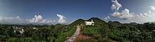
sai baba temple
| Meliaputti | |
|---|---|
| Village | |
 Meliaputti Location in Andhra Pradesh, India  Meliaputti Meliaputti (India) | |
| Coordinates: 18°46′00″N 84°10′00″E / 18.7667°N 84.1667°ECoordinates: 18°46′00″N 84°10′00″E / 18.7667°N 84.1667°E | |
| Country | India |
| State | Andhra Pradesh |
| District | Srikakulam |
| Talukas | Meliaputti |
| Area[1] | |
| • Total | 2.30 km2 (0.89 sq mi) |
| Population (2011)[1] | |
| • Total | 7,741 |
| • Density | 3,400/km2 (8,700/sq mi) |
| Languages | |
| • Official | Telugu |
| Time zone | UTC+5:30 (IST) |
| PIN | 532215 |
| Vehicle registration | AP |
| Lok Sabha constituency | Srikakulam |
| Vidhan Sabha constituency | Pathapatnam |
Meliaputti or Meliyaputti is a village in Srikakulam district of the Indian state of Andhra Pradesh. It is located in Meliaputti mandal of Palakonda revenue division.
Geography
Meliyaputti is located at 18°46′00″N 84°10′00″E / 18.7667°N 84.1667°E.[2] It has an average elevation of 74 meters (246 feet). River Mahendra tanaya flows besides the village.
Demographics
As of 2001 Indian census, the demographic details of Meliaputti mandal is as follows:[3]
- Total Population: 50,490 in 11,532 Households
- Male Population: 24,947 and Female Population: 25,543
- Children Under 6-years of age: 7,044 (Boys – 3,560 and Girls – 3,484)
- Total Literates: 22,766
References
- 1 2 "District Census Handbook – Srikakulam" (PDF). Census of India. The Registrar General & Census Commissioner. pp. 26, 164. Retrieved 13 May 2016.
- ↑ Falling Rain Genomics.Meliyaputtu
- ↑ Meliaputti mandal at Our Village India.org
This article is issued from
Wikipedia.
The text is licensed under Creative Commons - Attribution - Sharealike.
Additional terms may apply for the media files.