Medeho
| Medeho مديهو | |
|---|---|
| Town | |
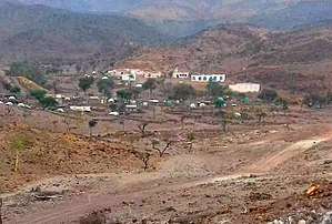 | |
 Medeho مديهو Location in Djibouti | |
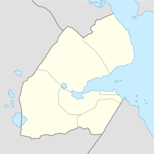
| Coordinates: 11°58′20″N 43°1′29″E / 11.97222°N 43.02472°E | |
| Country |
|
| Region | Obock |
| Elevation | 630 m (2,070 ft) |
Medeho (Arabic: مديهو) is a town in the northeastern Obock Region of Djibouti. Medeho has one of the mildest climates in Djibouti, which is not always passable during the rainy season. The town is overlooked by Mabla Mountains, the fifth tallest mountain in Djibouti.
Climate
Medeho has a hot semi-arid climate (BSh) in Köppen-Geiger system, with the influence of mountain climate.
| Climate data for Medeho | |||||||||||||
|---|---|---|---|---|---|---|---|---|---|---|---|---|---|
| Month | Jan | Feb | Mar | Apr | May | Jun | Jul | Aug | Sep | Oct | Nov | Dec | Year |
| Average high °C (°F) | 24.0 (75.2) |
24.3 (75.7) |
26.4 (79.5) |
28.4 (83.1) |
31.5 (88.7) |
34.7 (94.5) |
35.1 (95.2) |
34.1 (93.4) |
32.4 (90.3) |
29.0 (84.2) |
26.2 (79.2) |
24.4 (75.9) |
29.2 (84.6) |
| Average low °C (°F) | 14.3 (57.7) |
15.4 (59.7) |
16.6 (61.9) |
18.7 (65.7) |
21.0 (69.8) |
24.0 (75.2) |
23.6 (74.5) |
23.0 (73.4) |
22.7 (72.9) |
18.8 (65.8) |
16.4 (61.5) |
15.0 (59) |
19.1 (66.4) |
| Average precipitation mm (inches) | 36 (1.42) |
33 (1.3) |
19 (0.75) |
25 (0.98) |
11 (0.43) |
7 (0.28) |
24 (0.94) |
36 (1.42) |
37 (1.46) |
12 (0.47) |
35 (1.38) |
30 (1.18) |
305 (12.01) |
| Source: Climate-Data.org[1] | |||||||||||||
References
- ↑ "Climate: Medeho - Climate graph, Temperature graph, Climate table". Climate-Data.org. Retrieved 29 September 2016.
External links
Coordinates: 11°58′N 43°02′E / 11.967°N 43.033°E
This article is issued from
Wikipedia.
The text is licensed under Creative Commons - Attribution - Sharealike.
Additional terms may apply for the media files.