McLean, New York
| McLean, New York | |
|---|---|
| Hamlet | |
 McLean, New York  McLean, New York | |
| Coordinates: 42°33′07″N 76°17′28″W / 42.55194°N 76.29111°WCoordinates: 42°33′07″N 76°17′28″W / 42.55194°N 76.29111°W | |
| Country | United States |
| State | New York |
| County | Tompkins |
| Elevation | 1,122 ft (342 m) |
| Time zone | UTC-5 (Eastern (EST)) |
| • Summer (DST) | UTC-4 (EDT) |
| ZIP code | 13102 |
| Area code(s) | 607 |
| GNIS feature ID | 956826[1] |
McLean is a hamlet in Tompkins County, New York, United States. The community is 6.6 miles (10.6 km) west-southwest of Cortland. McLean has a post office with ZIP code 13102, which opened on June 30, 1826.[2][3]
References
- ↑ "McLean". Geographic Names Information System. United States Geological Survey.
- ↑ United States Postal Service. "USPS - Look Up a ZIP Code". Retrieved September 23, 2017.
- ↑ "Postmaster Finder - Post Offices by ZIP Code". United States Postal Service. Retrieved September 23, 2017.
Municipalities and communities of Tompkins County, New York, United States | ||
|---|---|---|
| City | 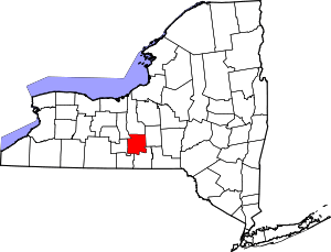 | |
| Towns | ||
| Villages | ||
| CDPs | ||
| Other hamlets | ||
This article is issued from
Wikipedia.
The text is licensed under Creative Commons - Attribution - Sharealike.
Additional terms may apply for the media files.